Blyth Hall

Log in to your account

AroundUs is a community-driven map of interesting places, built by curious explorers like you. It grows with every review, story, and photo you share.
Connect to save your favorite spots, contribute locations, and create personalized routes.
By continuing, you accept our Terms and Conditions and our Privacy Policy
Add to collection
Map
Suggest a change
Share

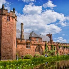
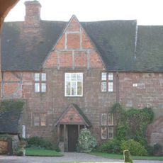
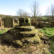
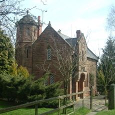
Blyth Hall, Grade I listed country house in Shustoke, England

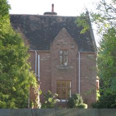
Blyth Hall is a red brick building in Shustoke with ten sash windows and five dormers topped with alternating curved and pointed pediments. The main entrance has a curved pediment, and the H-shaped structure holds two separate staircases with different design periods.

William Dugdale purchased and rebuilt the property in 1625, then lived there until 1686. During his time there, he created many works that recorded English history and family records.

The interior holds furniture and portraits from the 1600s that show how wealthy families lived back then. These pieces tell stories of daily life and the habits of people from that era.

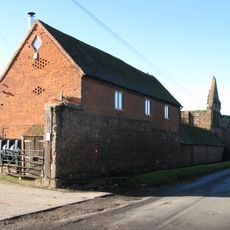
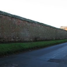
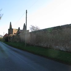
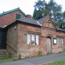
The building can be viewed from outside and shows the classic red brick architecture of the region. The adjacent stable block with its original curved gables provides a look at how historic outbuildings have been adapted over time.

The H-shaped layout holds two separate staircases from different eras, showing how the building was modified over time. An open-well staircase from the 1700s sits alongside one from the late 1600s, revealing changes in how people organized their homes.

Location: Shustoke

GPS coordinates: 52.50880,-1.69270

Latest update: December 12, 2025 17:43

Photos
Around this place
Maxstoke Castle
United Kingdom

Maxstoke Castle

1.8 km
Church of St Peter and St Paul, Coleshill
United Kingdom

Church of St Peter and St Paul, Coleshill

1.4 km
Maxstoke Priory
United Kingdom

Maxstoke Priory

4.3 km
The Pumping Station, Whitacre Waterworks
United Kingdom

The Pumping Station, Whitacre Waterworks

1.3 km
Church of St Nicholas and St Peter ad Vincula, Curdworth
United Kingdom

Church of St Nicholas and St Peter ad Vincula, Curdworth

4.1 km
Hemlingford
United Kingdom

Hemlingford

4 km
St Peter and St Paul's Church, Water Orton
United Kingdom

St Peter and St Paul's Church, Water Orton

3.4 km
Church of St Leonard
United Kingdom

Church of St Leonard

4.6 km
Church of St Giles
United Kingdom

Church of St Giles

3.5 km
Church of St Michael and All Angels
United Kingdom

Church of St Michael and All Angels

4.2 km
Church of St Cuthbert, Shustoke
United Kingdom

Church of St Cuthbert, Shustoke

3.4 km
Church of St John the Baptist
United Kingdom

Church of St John the Baptist

2.6 km
The Bulls Head Inn
United Kingdom

The Bulls Head Inn

4 km
Remains of Tower and Walls of Monastic Church Approximately 250 Metres South of Priory Farmhouse
United Kingdom

Remains of Tower and Walls of Monastic Church Approximately 250 Metres South of Priory Farmhouse

4.2 km
Blyth Bridge (That Part In Coleshill Civil Parish)
United Kingdom

Blyth Bridge (That Part In Coleshill Civil Parish)

325 m
Water Orton Bridge
United Kingdom

Water Orton Bridge

3.8 km
Priory Farmhouse
United Kingdom

Priory Farmhouse

4.1 km
Cole Bridge
United Kingdom

Cole Bridge

1.2 km
Coleshill War Memorial, Warwickshire
United Kingdom

Coleshill War Memorial, Warwickshire

1.4 km
Churchyard Cross At Church Of St Leonard
United Kingdom

Churchyard Cross At Church Of St Leonard

4.6 km
The Old Rectory
United Kingdom

The Old Rectory

4.1 km
Outer Gatehouse and Attached Precinct Walls and Barn 200 Metres North of Priory Farmhouse
United Kingdom

Outer Gatehouse and Attached Precinct Walls and Barn 200 Metres North of Priory Farmhouse

4.1 km
Churchyard cross, St Michael's churchyard
United Kingdom

Churchyard cross, St Michael's churchyard

4.2 km
Precinct Wall, East of Outer Gatehouse and Bounding Churchyard of St Michael and All Saints on the West
United Kingdom

Precinct Wall, East of Outer Gatehouse and Bounding Churchyard of St Michael and All Saints on the West

4.2 km
Precinct Wall, 60 Metres Northwest of Old Rectory
United Kingdom

Precinct Wall, 60 Metres Northwest of Old Rectory

4 km
Blythe Lodge
United Kingdom

Blythe Lodge

510 m
Village Hall
United Kingdom

Village Hall

4.6 km
Blyth Hall Packhorse Bridge
United Kingdom

Blyth Hall Packhorse Bridge

876 m
Show the full map
Reviews

Visited this place? Tap the stars to rate it and share your experience / photos with the community! Try now! You can cancel it anytime.

« Blyth Hall - Grade I listed country house in Shustoke, England » is provided by Around Us (aroundus.com). Images and texts are derived from Wikimedia project under a Creative Commons license. You are allowed to copy, distribute, and modify copies of this page, under the conditions set by the license, as long as this note is clearly visible.

Discover hidden gems everywhere you go!

From secret cafés to breathtaking viewpoints, skip the crowded tourist spots and find places that match your style. Our app makes it easy with voice search, smart filtering, route optimization, and insider tips from travelers worldwide. Download now for the complete mobile experience.

Around Us App Screenshot

A unique approach to discovering new places

Le Figaro

All the places worth exploring

France Info

A tailor-made excursion in just a few clicks

20 Minutes