Maxstoke Priory, Medieval monastery ruins in Maxstoke, England
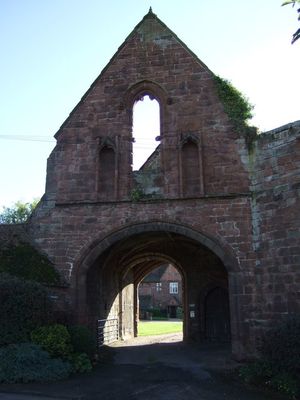
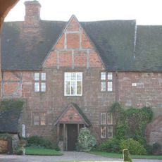
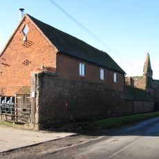
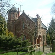
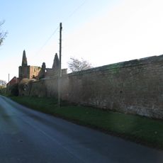
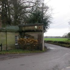
Maxstoke Priory consists of stone ruins from a medieval monastery, featuring a central tower, two gateways, and remnants of the infirmary building with architectural details from the 14th century. The surviving structures show the typical layout of an Augustinian establishment with distinct functional areas.
Sir William de Clinton founded the site in 1330 as a college of priests, then transformed it into an Augustinian monastery through royal approval in 1336. This change marked the shift from a secular priestly institution to a formal monastic community.
The monastery served as a center for music and religious education, with a choir school and organ that filled the church during services. This focus on learning and musical practice shaped the community's daily rhythm and drew educated clergy from surrounding regions.
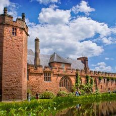
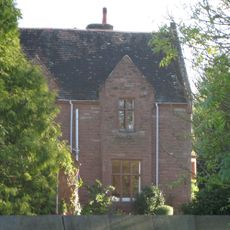
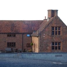
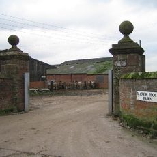
The inner gatehouse now operates as a guesthouse, while the outer gatehouse provides entry to the surrounding farmland. Visitors can explore the ruins by walking through the site and observing the different building traces.
Above the central window of the outer gatehouse are carved stone heads depicting a knight with lowered visor and a monk. These rare sculptures reveal the connection between secular power and religious authority that shaped this place.
Location: Maxstoke
Inception: 1330s
GPS coordinates: 52.47773,-1.65614
Latest update: December 14, 2025 14:23
Maxstoke Castle
2.6 km
Packington Hall
3.1 km
Blyth Hall
4.3 km
Church of St Peter and St Paul, Coleshill
4.1 km
St James' Church, Great Packington
2.7 km
Packington Old Hall
2.1 km
Church of St Cuthbert, Shustoke
4.4 km
Church of St Michael and All Angels
216 m
Church of St Bartholomew
3.3 km
Little Packington Bridge
2.3 km
Remains of Tower and Walls of Monastic Church Approximately 250 Metres South of Priory Farmhouse
44 m
Blyth Bridge (That Part In Coleshill Civil Parish)
3.9 km
Priory Farmhouse
130 m
The Old Rectory
155 m
Outer Gatehouse and Attached Precinct Walls and Barn 200 Metres North of Priory Farmhouse
186 m
Meriden Cross
4.5 km
Coleshill War Memorial, Warwickshire
4.1 km
Churchyard cross, St Michael's churchyard
216 m
Milepost Approximately 12 Metres North West Of Slowley Green Cottage (Not Included)
4.5 km
Stable Block, At Colliers Oak Farm
2.5 km
Stone House Farmhouse
2.8 km
Gate Pier, East Side Of Entrance To Manor House Farm
3.4 km
Blythe Lodge
3.8 km
Gatepier, West Side Of Entrance To Manor House Farm
3.4 km
Precinct Wall, 60 Metres Northwest of Old Rectory
237 m
The Lodge At Fillongley Hall
3.8 km
1 and 2, the Thatched Cottages
4.4 km
Precinct Wall, East of Outer Gatehouse and Bounding Churchyard of St Michael and All Saints on the West
205 mVisited this place? Tap the stars to rate it and share your experience / photos with the community! Try now! You can cancel it anytime.
Discover hidden gems everywhere you go!
From secret cafés to breathtaking viewpoints, skip the crowded tourist spots and find places that match your style. Our app makes it easy with voice search, smart filtering, route optimization, and insider tips from travelers worldwide. Download now for the complete mobile experience.
A unique approach to discovering new places❞
— Le Figaro
All the places worth exploring❞
— France Info
A tailor-made excursion in just a few clicks❞
— 20 Minutes