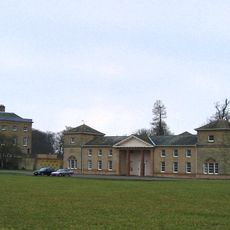
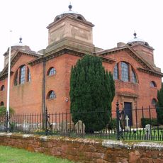
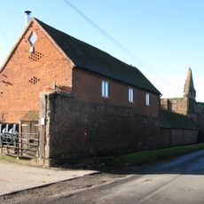
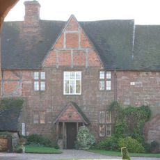
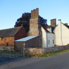
Packington Old Hall, Manor house in Great Packington, England.
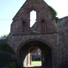
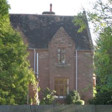
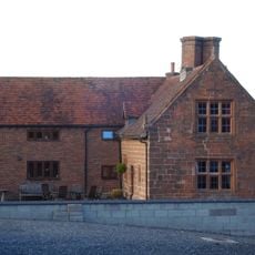
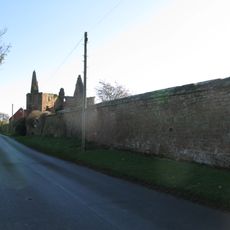
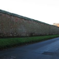
Packington Old Hall is a red brick manor house in Great Packington, enclosed by walls dating from the late 17th century. A brick dovecote nearby provides nesting spaces for about a hundred birds across multiple walls.
Sir Clement Fisher and Jane Lane rebuilt the manor house in 1679, creating a place of importance within England's estate landscape. The red brick construction and surrounding walls from this building period continue to define the property today.
The building displays traditional English manor features with red brick construction and spatial design that remain visible from the 17th century to today. The enclosed gardens and surviving outbuildings convey how estate properties functioned and were organized during that period.
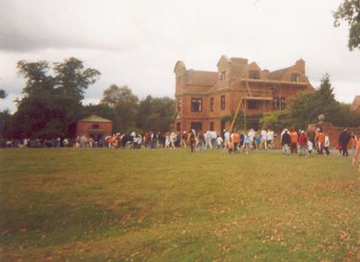
The site is normally only accessible by prior arrangement and is frequently used for events and private gatherings. It is therefore advisable to contact ahead to determine whether a visit is possible at specific times.
The dovecote was built as a separate structure from the main house and provided specialized space for bird breeding as an economic activity on the estate. This structure demonstrates how country properties in that era organized and managed their resources.
Location: Great Packington
GPS coordinates: 52.45900,-1.66170
Latest update: December 14, 2025 14:26
National Motorcycle Museum
3.5 km
Packington Hall
1.1 km
Cyclists War Memorial
2.5 km
St James' Church, Great Packington
543 m
Maxstoke Priory
2.1 km
Coventry Way
3.3 km
Church of St Lawrence
3.6 km
Church of St Michael and All Angels
2.3 km
Church of St Bartholomew
1.9 km
Little Packington Bridge
1.4 km
Meriden War Memorial
3 km
Remains of Tower and Walls of Monastic Church Approximately 250 Metres South of Priory Farmhouse
2.2 km
Hampton in Arden War Memorial
4.3 km
Old Station Bungalow
4.1 km
Outer Gatehouse and Attached Precinct Walls and Barn 200 Metres North of Priory Farmhouse
2.3 km
Meriden Cross
2.5 km
Priory Farmhouse
2.2 km
The Old Rectory
2.3 km
Churchyard cross, St Michael's churchyard
2.3 km
Stable Block, At Colliers Oak Farm
4.1 km
Stone House Farmhouse
4.3 km
1 and 2, the Thatched Cottages
2.4 km
Old Farmhouse
4 km
Precinct Wall, 60 Metres Northwest of Old Rectory
2.3 km
Precinct Wall, East of Outer Gatehouse and Bounding Churchyard of St Michael and All Saints on the West
2.3 km
Barn At Number 26
4.1 km
Milepost, Birmingham Road; by Wellesbourne, W of phone box & bus stop
4.3 km
Milepost, Main Road; in garden of Fairview, No. 198, next to entrance of School
3.2 kmVisited this place? Tap the stars to rate it and share your experience / photos with the community! Try now! You can cancel it anytime.
Discover hidden gems everywhere you go!
From secret cafés to breathtaking viewpoints, skip the crowded tourist spots and find places that match your style. Our app makes it easy with voice search, smart filtering, route optimization, and insider tips from travelers worldwide. Download now for the complete mobile experience.
A unique approach to discovering new places❞
— Le Figaro
All the places worth exploring❞
— France Info
A tailor-made excursion in just a few clicks❞
— 20 Minutes