Sluice, Channel And Sluice A Swing-Bridges At Vale Royal Locks
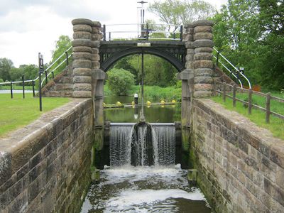
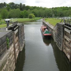
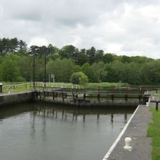
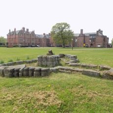
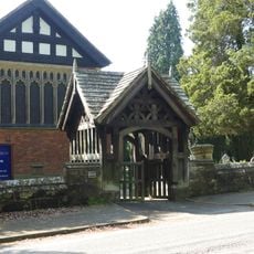
Sluice, Channel And Sluice A Swing-Bridges At Vale Royal Locks, Grade II listed sluice in Whitegate and Marton, United Kingdom.
The sluice system at Vale Royal Locks in Whitegate and Marton controls water flow along the River Weaver using channels and movable swing bridges that connect different water levels. These structures work together to direct water through the navigation system and maintain proper elevation changes.
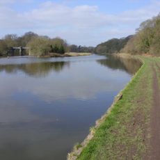
The locks were built in the 1900s as part of the River Weaver navigation system that enabled cargo transport in Cheshire. This development served the region's industrial needs and connected various waterway routes for shipping goods.
The Grade II listed structure stands as a testament to British hydraulic engineering, demonstrating the technical capabilities of twentieth-century construction methods.
You can view the locks and bridges from public footpaths that run alongside the water system. The site is best explored on foot, with views available from several vantage points along the channel route.
The swing bridges can still be operated by hand using mechanisms that date back to the early 1900s. This working system shows how engineers solved practical waterway problems with simple but clever mechanical designs.
Location: Whitegate and Marton
GPS coordinates: 53.22880,-2.54067
Latest update: December 15, 2025 13:24
Vale Royal Abbey
474 m
St Mary's Church, Whitegate
1.5 km
St John's Church, Hartford
1.9 km
St Stephen's Church, Moulton
1.7 km
Hartford Bridge, Cheshire
1.2 km
Moulton War Memorial
1.8 km
Vale Royal Railway Viaduct
386 m
Hartford Hall Hotel
1.4 km
Small Lock, lock gates and swing bridge, Vale Royal Locks
16 m
Lock, lock gates and swing-bridge, forming Large Lock, Vale Royal
44 m
Hartford War Memorial
1.9 km
Whitegate War Memorial
1.5 km
Whitegate Cottage
1.6 km
Lock keeper's cottage at Vale Royal Locks
172 m
Fountain
2.1 km
Gatepiers in churchyard of St Mary
1.5 km
The Lodge
1.4 km
The Nun's Grave Cross
433 m
Whitegate House
1.5 km
Flood gates and sluice bridge
731 m
Former stable block at Vale Royal Abbey
601 m
Lych-gate in churchyard of St Mary
1.5 km
Bark House Farmhouse
1.6 km
1, Green Lane
2 km
The Hollies
1.6 km
Front wall and steps to Whitehall
1.6 km
Turnpike Milepost Between Number 453 And Number 455
1.9 km
Milepost, Chester Road; half mile W of railway station
1.9 kmVisited this place? Tap the stars to rate it and share your experience / photos with the community! Try now! You can cancel it anytime.
Discover hidden gems everywhere you go!
From secret cafés to breathtaking viewpoints, skip the crowded tourist spots and find places that match your style. Our app makes it easy with voice search, smart filtering, route optimization, and insider tips from travelers worldwide. Download now for the complete mobile experience.
A unique approach to discovering new places❞
— Le Figaro
All the places worth exploring❞
— France Info
A tailor-made excursion in just a few clicks❞
— 20 Minutes