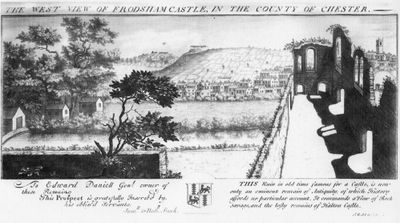
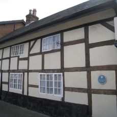
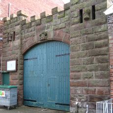
Frodsham Castle, Medieval castle ruins in Frodsham, England.
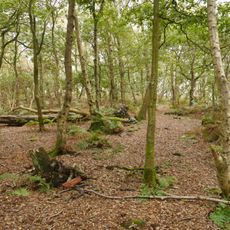
Frodsham Castle comprises medieval ruins positioned on elevated ground at the western edge of town, situated between Frodsham Marsh and Overton Hill. The remains now form the core of Castle Park House and its surrounding grounds, which feature formal gardens, walking paths, and open spaces accessible to the public.
Hugh Lupus, Earl of Chester, built the original wooden fortress around 1070, which stood for centuries before collapsing during the 14th century. It was subsequently rebuilt but eventually abandoned as military needs changed.
The castle grounds now serve as a public space where people walk and enjoy nature among the old stone foundations. This transformation shows how defensive structures were repurposed into places for peaceful leisure over time.
The site is best explored on foot, with walking paths leading through the grounds and around the ruins. Visit during daylight hours to fully appreciate the gardens and the layout of the stone remains.
In 1654, John Savage, Earl Rivers, died at the castle, and while his body awaited burial, a devastating fire destroyed the remaining structures. This unusual event marked the definitive end of the castle as an inhabited place.
GPS coordinates: 53.29260,-2.73090
Latest update: December 8, 2025 21:07
St Laurence's Church, Frodsham
787 m
Bear's Paw Hotel, Frodsham
508 m
Woodhouse Hill Camp
1.8 km
The Golden Lion
494 m
Queen's Head Hotel
402 m
Ring O Bells Inn
776 m
Old Hall Hotel
348 m
War memorial cross in the churchyard of St Laurence's Church
773 m
Rock Villa
862 m
Frodsham Viaduct Number 53
1.8 km
Frodsham War Memorial Gates and Railings
900 m
85 and 89, Main Street
367 m
56, Hillside Road
845 m
Frodsham War Memorial
623 m
Wright tomb 1 metre east of south pier of west gate to St Lawrence's Churchyard
754 m
K4 telephone kiosk north of railway bridge
488 m
Lloyds TSB Bank
424 m
Ashley House
260 m
Church House Farmhouse
883 m
Overton House
886 m
84, Main Street
358 m
Brook House
198 m
Sundial 9 metres south of south porch of St Lawrence's Church
779 m
Stable on east side of yard behind Queen's Head Hotel
405 m
Entrance to army premises adjoining number 52 Main Street
258 m
52, Main Street
240 m
83, Main Street
362 m
Shippon 10 Metres South Of Manor Farmhouse
988 mVisited this place? Tap the stars to rate it and share your experience / photos with the community! Try now! You can cancel it anytime.
Discover hidden gems everywhere you go!
From secret cafés to breathtaking viewpoints, skip the crowded tourist spots and find places that match your style. Our app makes it easy with voice search, smart filtering, route optimization, and insider tips from travelers worldwide. Download now for the complete mobile experience.
A unique approach to discovering new places❞
— Le Figaro
All the places worth exploring❞
— France Info
A tailor-made excursion in just a few clicks❞
— 20 Minutes