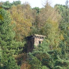
Woodhouse Hill Camp, Iron Age hillfort in Frodsham, England
Description
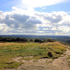
Woodhouse Hill Camp is an Iron Age hillfort in Frodsham featuring natural steep cliffs on its western edge and constructed ramparts along the northern and eastern sides. The site combines natural terrain with human-made defensive structures to create a fortified enclosure.
History
The fort dates to the Iron Age and served early inhabitants as a fortified settlement location. Archaeological investigation revealed that inhabitants used stone and earth to construct their defensive structures.
Culture
The name references the hilltop setting where early inhabitants built their settlement. The earthworks visible today show how those people used and defended their chosen location.
Practical
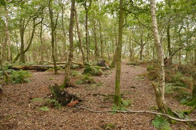
The site sits within Snidley Moor Wood and is accessible to visitors. Expect uneven ground and potentially damp conditions typical of woodland areas.
Did you know?
Rounded stones discovered at the site suggest inhabitants produced projectiles for defense. These finds reveal details about the weapons used by early residents.
AroundUs brings together thousands of curated places, local tips, and hidden gems, enriched daily by 60,000 contributors worldwide. Discover all places nearby (Frodsham).
Helsby hill fort
1.9 km
Frodsham Castle
1.8 km
St Laurence's Church, Frodsham
1.9 km
St Paul's Church, Helsby
1.7 km
Alvanley Hall
2.1 km
St John the Evangelist's Church, Alvanley
2.1 km
Helsby War Memorial
1.7 km
Folly tower south west of Fox Hill
732 m
Ring O Bells Inn
1.8 km
War memorial cross in the churchyard of St Laurence's Church
1.9 km
Frodsham War Memorial
1.5 km
Commonside Farmhouse
1.5 km
Frodsham War Memorial Gates and Railings
1.4 km
56, Hillside Road
1.8 km
Wright tomb 1 metre east of south pier of west gate to St Lawrence's Churchyard
1.9 km
Overton House
1.9 km
Guidepost At Four Lane End
1.8 km
The Paddocks
1.5 km
Church House Farmhouse
1.9 km
Ashley House
2.1 km
Sundial 9 metres south of south porch of St Lawrence's Church
1.9 km
84, Main Street
2.1 km
Brook House
2 km
Entrance to army premises adjoining number 52 Main Street
2.1 km
Manor House Farmhouse
2 km
52, Main Street
2 km
L-shaped farm building 15 metres south east of Riley Bank Farmhouse
1.5 km
Alvanley House
2.1 kmDiscover hidden gems everywhere you go!
From secret cafés to breathtaking viewpoints, skip the crowded tourist spots and find places that match your style. Our app makes it easy with voice search, smart filtering, route optimization, and insider tips from travelers worldwide. Download now for the complete mobile experience.
A unique approach to discovering new places❞
— Le Figaro
All the places worth exploring❞
— France Info
A tailor-made excursion in just a few clicks❞
— 20 Minutes