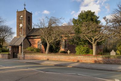
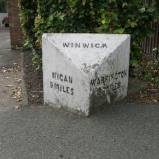
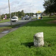
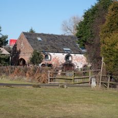
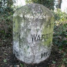
Burtonwood and Westbrook, civil parish in Warrington, Cheshire, England
Location: Warrington
Shares border with: Great Sankey
GPS coordinates: 53.43015,-2.66135
Latest update: March 3, 2025 01:34
Gulliver's World Resort
3.9 km
Sankey Viaduct
2.1 km
St Oswald's Church, Winwick
4.2 km
Sankey Valley Park
4.4 km
Bewsey Old Hall
4.3 km
St John the Baptist's Church, Earlestown
2.8 km
Earlestown Town Hall
2.8 km
Church of St Mary and St John, Newton-le-Willows
3.5 km
Emmanuel Wargrave Church
2.8 km
Church of St Michael and All Angels, Burtonwood
367 m
Mill Lane viaduct, Newton-le-Willows
4 km
Bradlegh Old Hall
1.5 km
Bradley Swing Bridge, Sankey Canal
2.2 km
Newton-le-Willows Library
3.3 km
St Patrick's Church, Earlestown
2.6 km
All Saints, Newton-le-Willows
3.3 km
St David's Church, Newton-le-Willows
2.9 km
159 - 163 Crow Lane East, Newton-le-Willows
3.5 km
Waiting room at Earlestown railway station
2.8 km
Earlestown War Memorial
2.8 km
Earlestown Market Cross
2.8 km
Newton Park farmhouse, Newton-le-Willows
4.2 km
Bradley Lock, Sankey Canal
2 km
Milestone, Golborne Road, opp. jcn Hornby Lane
4.2 km
Milestone, Winwick Road, 100m after Poplars Avenue junction
4.4 km
Premises Of Gordan Sheds
3.6 km
Milestone, Newton Road
4 km
Gatehouse to Bradlegh Old Hall
1.5 kmReviews
Visited this place? Tap the stars to rate it and share your experience / photos with the community! Try now! You can cancel it anytime.
Discover hidden gems everywhere you go!
From secret cafés to breathtaking viewpoints, skip the crowded tourist spots and find places that match your style. Our app makes it easy with voice search, smart filtering, route optimization, and insider tips from travelers worldwide. Download now for the complete mobile experience.
A unique approach to discovering new places❞
— Le Figaro
All the places worth exploring❞
— France Info
A tailor-made excursion in just a few clicks❞
— 20 Minutes