
Trees, building in Woolsington, Newcastle upon Tyne, Tyne and Wear, UK
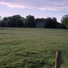
Woolsington Hall
644 m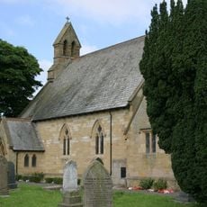
Church of St Matthew
3.1 km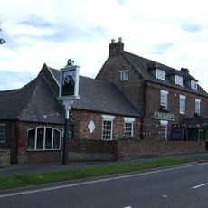
The Badger Inn
2.4 km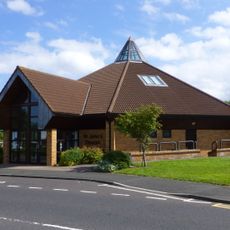
Church of St John the Evangelist
2.4 km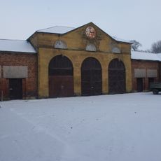
Stables And Coachhouse, North Of Woolsington Hall
651 m
Bullock Steads Farmhouse
1.3 km
Garden Walls South And East Of Prestwick Hall
2.5 km
House, South East Of Bullock Steads Farmhouse, And Farm Buildings Attached
1.4 km
Whorlton Grange
2.4 km
Prestwick Hall
2.6 km
Former School
3.1 km
Piers, Walls And Railings, East Of Church Of St Matthew And Former School
3.2 km
Gas Lamps At Entrance To South Drive
914 m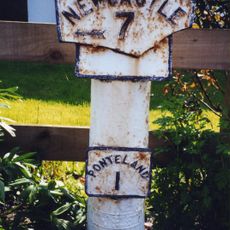
Milepost, Ponteland Road, by parking lane before Elm Road jct
2.7 km
Havannah Nature Reserve
3 km
Scenic viewpoint
2.3 km
East Wing Of Woolsington Hall
602 m
Orangery, East Of Woolsington Hall
623 m
Gate Piers And Walls At Entrance To South Drive
914 m
Orion Cinema
3 km
Westerhope Golf Club
2.3 km
Red House Farmhouse
3.1 km
Bath House Approximately 20 Yards South-East Of Prestwick Hall
2.6 km
Step Pyramid
3.2 km
Small step pyramid
3.1 km
Sculpture, Work of art
2.5 km
Coal workings at Dewley Pits, 650m south west of Black Callerton
3.1 km
Scenic viewpoint
1.5 kmReviews
Visited this place? Tap the stars to rate it and share your experience / photos with the community! Try now! You can cancel it anytime.
Discover hidden gems everywhere you go!
From secret cafés to breathtaking viewpoints, skip the crowded tourist spots and find places that match your style. Our app makes it easy with voice search, smart filtering, route optimization, and insider tips from travelers worldwide. Download now for the complete mobile experience.

A unique approach to discovering new places❞
— Le Figaro
All the places worth exploring❞
— France Info
A tailor-made excursion in just a few clicks❞
— 20 Minutes