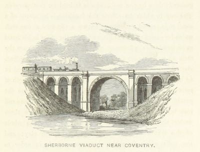
Sherbourne Viaduct, Railway viaduct in Coventry, England.
Sherbourne Viaduct crosses the River Sherbourne using one large central arch and three smaller arches positioned on each side. The red brick structure displays the solid, functional design typical of Victorian railway infrastructure built to last.
Robert Stephenson designed this brick bridge in 1838 as part of the London and Birmingham Railway extending through central England. The construction represents early railway engineering achievements at a time when viaducts had to overcome river valleys and geological obstacles.
The structure was granted Grade II listed status in 2015, honoring its role in early Victorian railway engineering. The design demonstrates the technical advances engineers achieved when overcoming obstacles such as river crossings.
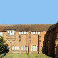
The viaduct is accessible by footpaths from Shortley Road or London Road, with bus stops nearby for public transport. The location is well-connected within the city, making it easy to reach from multiple walking routes through Coventry.
The viaduct displays blue and grey patches among its orange bricks, possibly indicating camouflage paint or repairs throughout its history spanning more than 180 years. These color variations tell a quiet story of change and maintenance across multiple generations.
The community of curious travelers
AroundUs brings together thousands of curated places, local tips, and hidden gems, enriched daily by 60,000 contributors worldwide.