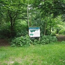
Wrabness Nature Reserve, Nature reserve in Essex, England
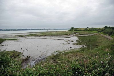
Wrabness Nature Reserve is a protected area stretching along the River Stour in Essex, featuring grasslands, marshes, scrubland, and woodland habitats spread across about 27 hectares (67 acres). These varied landscapes support diverse wildlife and create different ecological zones throughout the site.
The site functioned as a military mine depot until 1963, when it was abandoned and eventually transformed into a nature reserve. Official protection came in 1992 when the Wrabness Nature Reserve Charitable Trust was established to manage the land.
The reserve is managed by Essex Wildlife Trust, which runs regular guided walks and workshops for visitors interested in understanding local wildlife and conservation. Local groups and schools use the paths to connect with nature and learn about the habitats they encounter.
The reserve is open year-round with marked pathways that visitors can walk on, and some routes are accessible for wheelchair users with the proper key. Wear appropriate clothing for changing weather, especially when exploring the wetter marshy areas.
Jacques Bay within the reserve transforms into a feeding ground for black-tailed godwits and turnstones during winter as they forage through the mud. This seasonal gathering offers birdwatchers a special opportunity to observe these migratory species in their natural feeding patterns.
The community of curious travelers
AroundUs brings together thousands of curated places, local tips, and hidden gems, enriched daily by 60,000 contributors worldwide.