Clay County

Log in to your account

AroundUs is a community-driven map of interesting places, built by curious explorers like you. It grows with every review, story, and photo you share.
Connect to save your favorite spots, contribute locations, and create personalized routes.
By continuing, you accept our Terms and Conditions and our Privacy Policy

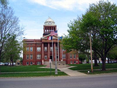
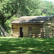
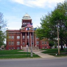
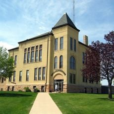
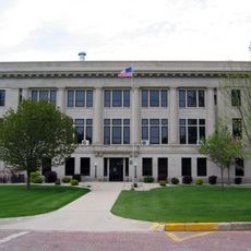
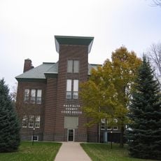
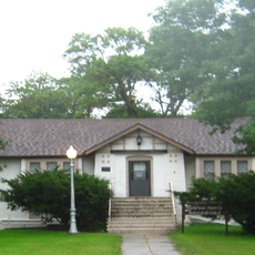
Clay County, county in Iowa, United States

Location: Iowa

Inception: 1851

Capital city: Spencer

Website: http://www.co.clay.ia.us

Shares border with: Dickinson County, Buena Vista County, Osceola County, O'Brien County, Cherokee County, Emmet County, Palo Alto County, Pocahontas County

Website: http://co.clay.ia.us

GPS coordinates: 43.08083,-95.14944

Latest update: May 4, 2025 10:35

Around this place
Show the full map
West Okoboji Lake
United States of America

West Okoboji Lake

33.8 km
Spirit Lake Massacre
United States of America

Spirit Lake Massacre

38 km
Arnold's Park
United States of America

Arnold's Park

31.7 km
Gull Point State Park
United States of America

Gull Point State Park

32.3 km
Pillsbury Point State Park
United States of America

Pillsbury Point State Park

31.9 km
Spirit Lake Massacre Log Cabin
United States of America

Spirit Lake Massacre Log Cabin

31.7 km
Indian Village Site
United States of America

Indian Village Site

24.9 km
Clay County Courthouse
United States of America

Clay County Courthouse

6.8 km
Dickinson County Courthouse
United States of America

Dickinson County Courthouse

38.2 km
O'Brien County Courthouse
United States of America

O'Brien County Courthouse

38.9 km
Emmet County Courthouse
United States of America

Emmet County Courthouse

44 km
Palo Alto County Courthouse
United States of America

Palo Alto County Courthouse

38.5 km
Old Spirit Lake Public Library
United States of America

Old Spirit Lake Public Library

38.2 km
Emmetsburg Public Library
United States of America

Emmetsburg Public Library

38.6 km
Laurens Carnegie Free Library
United States of America

Laurens Carnegie Free Library

35.4 km
Gerome Clark House
United States of America

Gerome Clark House

28.6 km
Logan Center School No.5
United States of America

Logan Center School No.5

15 km
Pearson Lakes Art Center
United States of America

Pearson Lakes Art Center

35.1 km
Abbie Gardner Cabin
United States of America

Abbie Gardner Cabin

31.7 km
Brooks Beach
United States of America

Brooks Beach

34 km
Marble Beach
United States of America

Marble Beach

43.4 km
Miniwaukon Beach
United States of America

Miniwaukon Beach

41.4 km
Dixon Beach
United States of America

Dixon Beach

33.9 km
Chalstroms Beach
United States of America

Chalstroms Beach

34.2 km
Memorial Park
United States of America

Memorial Park

28 km
East Okoboji Beach
United States of America

East Okoboji Beach

37.3 km
Orleans Beach
United States of America

Orleans Beach

41.2 km
Gull Point Beach
United States of America

Gull Point Beach

32.4 km
Show the full map

Reviews

Visited this place? Tap the stars to rate it and share your experience / photos with the community! Try now! You can cancel it anytime.

Administrative divisions
« Clay County - county in Iowa, United States » is provided by Around Us (aroundus.com). Images and texts are derived from Wikimedia project under a Creative Commons license. You are allowed to copy, distribute, and modify copies of this page, under the conditions set by the license, as long as this note is clearly visible.

Discover hidden gems everywhere you go!

From secret cafés to breathtaking viewpoints, skip the crowded tourist spots and find places that match your style. Our app makes it easy with voice search, smart filtering, route optimization, and insider tips from travelers worldwide. Download now for the complete mobile experience.

Around Us App Screenshot

A unique approach to discovering new places

Le Figaro

All the places worth exploring

France Info

A tailor-made excursion in just a few clicks

20 Minutes