Enable Location

We need your location to show you interesting places around you

Discover nearby places

Find interesting locations and hidden gems around you

Precise directions

Get accurate directions and distances to places

Your location is never shared with other users. It's only used when you tap the location button.

Log in to your account

Start exploring — it's free

Trusted by 61,987 travelers worldwide

Continue with Google
Continue with Apple
or

We will send you a code to connect

By continuing, you accept our Terms and Conditions and our Privacy Policy

Check your inbox

We've sent a pincode in your inbox. Please enter the code below.

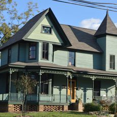
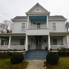
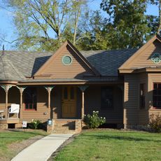
Five Points Historic Neighborhoods, Historic district in Raleigh, United States

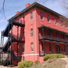
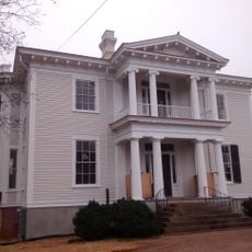
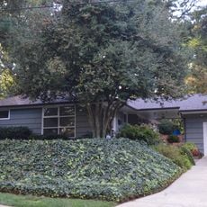
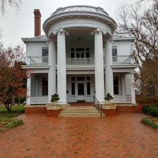
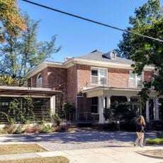
Five Points Historic Neighborhoods is a collection of five residential areas where Glenwood Avenue, Fairview Road, and Whitaker Mill Road meet, featuring architecture from the early 20th century. The neighborhoods of Hayes Barton, Bloomsbury, Georgetown, Vanguard Park, and Roanoke Park together form a residential zone with varied building styles and home types.

The district formed between 1910 and 1920 during Raleigh's second phase of suburban expansion, as the city grew beyond its original boundaries. This growth reflected rising prosperity and improved transportation connections through streetcar lines.

The area became a gathering place for Raleigh's LGBT community starting in the 1950s, with venues like The Mousetrap serving as important social hubs.

The area provides pedestrians with good access to parks, shops, restaurants, and the Rialto Theatre. Walking is practical here since these amenities are located within easy reach of one another.

In 1918, an electric utility company built an amusement park here with a carousel and roller coaster to encourage streetcar usage and electricity consumption. This park was part of an early marketing strategy to promote the adoption of new technologies.

The community of curious travelers

AroundUs brings together thousands of curated places, local tips, and hidden gems, enriched daily by 60,000 contributors worldwide.

Start exploring
Location
GPS coordinates
35.80390,-78.64577
Latest update
December 12, 2025 14:23
Around this place
Mordecai House
United States of America

Mordecai House

1.7 km
North Carolina State Legislative Building
United States of America

North Carolina State Legislative Building

2.4 km
Merrimon-Wynne House
United States of America

Merrimon-Wynne House

2.1 km
Josephus Daniels House
United States of America

Josephus Daniels House

552 m
Holy Trinity Anglican Church
United States of America

Holy Trinity Anglican Church

2 km
Peace College Main Building
United States of America

Peace College Main Building

1.8 km
Rev. M.L. Latta House
United States of America

Rev. M.L. Latta House

1.7 km
Haywood Hall
United States of America

Haywood Hall

2.2 km
United States of America

Mordecai Place Historic District

1.8 km
St. Mark's Chapel
United States of America

St. Mark's Chapel

1.7 km
Andrews-Duncan House
United States of America

Andrews-Duncan House

2.3 km
Occidental Life Insurance Company Building
United States of America

Occidental Life Insurance Company Building

1.2 km
Carolina Power and Light Company Car Barn and Automobile Garage
United States of America

Carolina Power and Light Company Car Barn and Automobile Garage

2.4 km
Raleigh and Gaston / Seaboard Coast Line Building
United States of America

Raleigh and Gaston / Seaboard Coast Line Building

2.1 km
Lewis-Smith House
United States of America

Lewis-Smith House

2.2 km
North Carolina School for the Blind and Deaf Dormitory
United States of America

North Carolina School for the Blind and Deaf Dormitory

2.4 km
Milton Small House
United States of America

Milton Small House

2.2 km
G. Dewey and Elma Arndt House
United States of America

G. Dewey and Elma Arndt House

2.2 km
Willis M. Graves House
United States of America

Willis M. Graves House

1.7 km
Isabelle Bowen Henderson House and Gardens
United States of America

Isabelle Bowen Henderson House and Gardens

2.4 km
John T. and Mary Turner House
United States of America

John T. and Mary Turner House

1.5 km
Rev. Plummer T. Hall House
United States of America

Rev. Plummer T. Hall House

1.6 km
Dr. Hubert Benbury Haywood House
United States of America

Dr. Hubert Benbury Haywood House

1.9 km
Wachovia Building Company Contemporary Ranch House
United States of America

Wachovia Building Company Contemporary Ranch House

1.3 km
Garland Scott and Toler Moore Tucker House
United States of America

Garland Scott and Toler Moore Tucker House

2.3 km
Light+Time Tower
United States of America

Light+Time Tower

891 m
Raleigh Bonded Warehouse
United States of America

Raleigh Bonded Warehouse

1.6 km
Mordecai Historic Park Visitor Center
United States of America

Mordecai Historic Park Visitor Center

1.7 km
Show the full map
« Five Points Historic Neighborhoods - Historic district in Raleigh, United States » is provided by Around Us (aroundus.com). Images and texts are derived from Wikimedia project under a Creative Commons license. You are allowed to copy, distribute, and modify copies of this page, under the conditions set by the license, as long as this note is clearly visible.

Discover hidden gems everywhere you go!

From secret cafés to breathtaking viewpoints, skip the crowded tourist spots and find places that match your style. Our app makes it easy with voice search, smart filtering, route optimization, and insider tips from travelers worldwide. Download now for the complete mobile experience.

Around Us App Screenshot

A unique approach to discovering new places

Le Figaro

All the places worth exploring

France Info

A tailor-made excursion in just a few clicks

20 Minutes

Around Us
Travel Guide & Maps
Download

Send to your phone

QR Code
1

Open the camera app on your mobile.

2

Point at the QR code with your camera. A notification will appear.

3

Tap the notification to open the link.