HMS Forest Moor, Naval shore establishment in Nidderdale, North Yorkshire, England
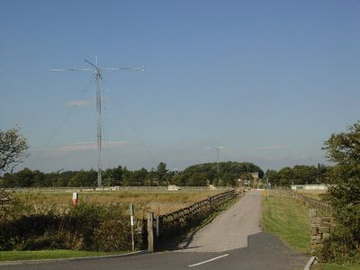
HMS Forest Moor was a Royal Navy communications facility in Nidderdale that operated as a high-frequency receiver station for maritime signals. The establishment occupied an extensive site where naval personnel received radio transmissions from locations around the world and directed them to command centers.
The station was established in 1960 and became crucial for coordinating naval radio communications between the British fleet and deployments worldwide. After its military operations ended, the site transitioned to a different use and purpose.
The facility served as a vital communications hub where Royal Navy personnel worked around the clock to receive and relay signals globally. Radio operators and technicians here kept the Royal Navy connected with vessels and bases across the world, making it essential to naval operations.
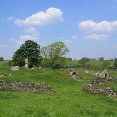
The site was located in a rural area with limited public access and was restricted to authorized military personnel during operation. Visitors should note that the facility no longer operates as a military installation and the grounds now serve a different purpose.
The station worked in coordination with a transmitter facility in Lancashire, creating a networked system where reception and transmission were handled at separate locations. This distributed approach allowed signals to be efficiently managed across the region.
Inception: October 1960
GPS coordinates: 54.01170,-1.72111
Latest update: December 10, 2025 20:00
John O'Gaunt's Castle
4.6 km
Timble Inn
4.4 km
Church of St Saviour
2.2 km
Church of the Holy Trinity
5.2 km
Church of St Lawrence
3.4 km
Church of St Andrew
2.6 km
The Royal Oak Public House
4.8 km
Dacre Hall
3.6 km
Summer Bridge Summer Bridge Over River Nidd
5.3 km
Swinsty Hall
4.3 km
Medieval royal hunting lodge known as John of Gaunt's Castle, immediately north west of Haverah Park Top
4.5 km
Mile-Post At Junction With Maegill Lane
1.6 km
Sundial In Graveyard Approximately 15 Metres South Of Providence Chapel
3.7 km
Thornthwaite packhorse bridge
2.3 km
Pump
4.9 km
Milepost At Se 2096 5612
2.8 km
Milepost At Se 2242 5618
4.2 km
Milestone, W of Reservoir, jct North Moor Road, Whitmoor Road, West End Road
3.6 km
Gate Hill Farmhouse
5 km
Southfield Farmhouse
3.5 km
Mile Post Approximately 30 Metres West Of Paradise
4.2 km
Barn And Byre 10 Metres North Of Lane Foot Farmhouse
4.4 km
Milestone, W of Stripe Lane
5.2 km
Guidestone, Back Road, High Birstwith
3.5 km
Guidestone, W of B6451, Menwith Hill Road
240 m
Guidestone, Thornthwaite Bridge
1.3 km
Guidestone, W of Reservoir, jct North Moor Road, Whitmoor Road, West End Road
3.6 km
Swinsty Reservoir
4.2 kmVisited this place? Tap the stars to rate it and share your experience / photos with the community! Try now! You can cancel it anytime.
Discover hidden gems everywhere you go!
From secret cafés to breathtaking viewpoints, skip the crowded tourist spots and find places that match your style. Our app makes it easy with voice search, smart filtering, route optimization, and insider tips from travelers worldwide. Download now for the complete mobile experience.
A unique approach to discovering new places❞
— Le Figaro
All the places worth exploring❞
— France Info
A tailor-made excursion in just a few clicks❞
— 20 Minutes