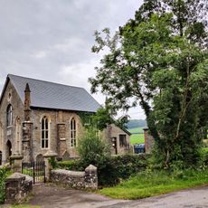
The Guildhall, Grade II listed building in Llantrisant, Wales.
The Guildhall is a Grade II listed stone building with prominent windows and traditional Welsh architectural features located in the town center. The structure displays robust stone walls and a distinctive facade that anchors the core of the town.
The building was erected as an administrative center for the town and has maintained its function as the seat of local governance since its establishment. It has long been the heart of municipal administration and decision-making for the community.
The building serves as a gathering space for community events and local meetings where residents come together for civic matters. It embodies the role of a municipal hub that shapes the social life of the town.
The building is situated on the main street and is easily accessible on foot, with parking options and bus connections nearby. Visitors should explore the central areas and check locally for current opening times and any visitor guidelines.
The building houses historical documents and artifacts that record the town's development over several centuries. These collections tell the story of the local community and its important milestones.
Location: Llantrisant
Elevation above the sea: 148.8 m
GPS coordinates: 51.54192,-3.37504
Latest update: December 14, 2025 16:41
Llantrisant Castle
46 m
Church Of St Illtyd, St Gwynno And St Dyfodwg
104 m
Church of St Michael and All Angels
2 km
Statue of Dr William Price
58 m
St David's Church
2.6 km
Castellau Congregational Chapel
2.3 km
Caerau, Llantrisant
1.7 km
Ebenezer Calvinistic Methodist Chapel
2.7 km
Penuel Presbyterian Church of Wales including forecourt walls and railings
122 m
Gates, piers, boundary walls and bridge at Castellau Congregational Chapel
2.2 km
Miskin Arms
2.6 km
New Inn
54 m
Llantrisant Library
309 m
Pontyclun Library
2.7 km
Beddau Library
2.1 km
Cow Shed at Ynysmaerdy Farm (formerly stores of Llantrisant Colliery)
1.6 km
The Malthouse
377 m
Miskin War Memorial
2.6 km
Wall with bee boles at Tondrugwaer
1.1 km
Y Felin Wynt Tower
442 m
2 Yr Allt And Adjoining Property To Left, Llantrisant
89 m
Former Stable adjoining 2 Yr Allt
84 m
Boiler stack of former lead mine NW of Cefn-parc Farm
1.3 km
Cefn Mabley Farmhouse
341 m
Hay barn at Ynysmaerdy Farm (former winding engine house of Llantrisant Colliery)
1.5 km
Parish Offices
52 m
Garage at Ynysmaerdy Farm (formerly part of Llantrisant Colliery)
1.5 km
Telephone Call-box
2.6 kmVisited this place? Tap the stars to rate it and share your experience / photos with the community! Try now! You can cancel it anytime.
Discover hidden gems everywhere you go!
From secret cafés to breathtaking viewpoints, skip the crowded tourist spots and find places that match your style. Our app makes it easy with voice search, smart filtering, route optimization, and insider tips from travelers worldwide. Download now for the complete mobile experience.
A unique approach to discovering new places❞
— Le Figaro
All the places worth exploring❞
— France Info
A tailor-made excursion in just a few clicks❞
— 20 Minutes