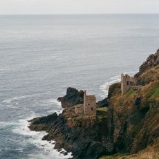
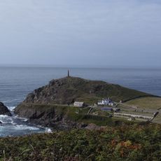
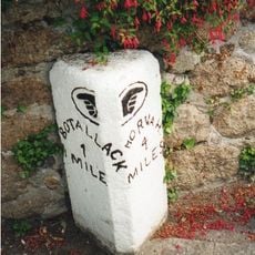
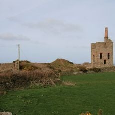
Crown Mines, Mining ruins in Botallack, United Kingdom.
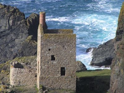
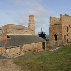
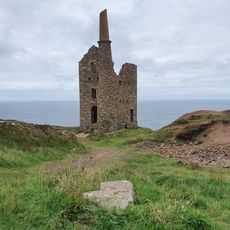
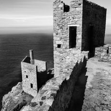
Crown Mines are the remains of copper and tin extraction operations perched on granite cliffs above the Atlantic. Two stone engine houses stand at the site, their thick walls built to house the machinery that powered the mining work.
Mining operations began here in 1721 and continued until 1914. During this time, underground shafts extended far beneath the ocean floor to reach the mineral deposits.
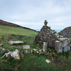
The industrial structures here reflect Cornwall's mining past and earned UNESCO World Heritage recognition in 2006. You can see how closely miners worked with this harsh coastal landscape.
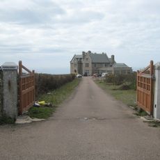
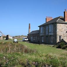
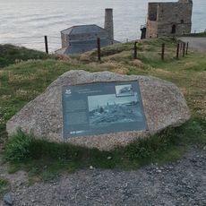
The National Trust manages the site and provides parking near the Count House Workshop, which serves as an information center. The grounds are accessible on foot, though the clifftop paths are steep and exposed to wind and weather.
Minerals were extracted through the Boscawen Diagonal Shaft, which descended at a steep angle beneath the ocean floor. This engineering feat allowed workers to mine directly under the sea, an unusual achievement for the time.
GPS coordinates: 50.14310,-5.69320
Latest update: December 14, 2025 09:41
Geevor Tin Mine
1.6 km
Levant Mine and Beam Engine
1.1 km
St Just in Penwith Parish Church
2.3 km
Priest Cove
2.2 km
Botallack Manor House
697 m
The Queen's Arms Inn
972 m
The Kings Arms Inn
2.3 km
Church of St John the Baptist
2.1 km
Porthledden House
1.8 km
War Memorial Clock Tower
2.2 km
The Crowns Engine Houses
17 m
Mining Chimney
2.1 km
The Count House, Botallack Mine North West Of Botallack
447 m
Cargodna Pumping House
648 m
Medieval chapel called St Helen's Chapel with a dwelling and enclosure at Cape Cornwall
1.9 km
Cape Cornwall Chimney
2.1 km
Churchyard cross in St Just's churchyard, 10m west of the church
2.3 km
Cross slab at parish church
2.3 km
K6 Telephone Kiosk
2.3 km
Tin mine calciner at Botallack Mine
351 m
Levant Engine Houses
1.1 km
Milestone Approximately 28M S Of No. 1 Trenhare
1.8 km
1 and 2, Market Street
2.3 km
Churchyard Wall
2.3 km
6, Market Square
2.3 km
Wayside cross immediately north east of St John the Baptist's Church
2.2 km
Methodist Church (former Wesleyan Chapel) And Attached Vestry
2.1 km
Higher Levant Mine
952 mVisited this place? Tap the stars to rate it and share your experience / photos with the community! Try now! You can cancel it anytime.
Discover hidden gems everywhere you go!
From secret cafés to breathtaking viewpoints, skip the crowded tourist spots and find places that match your style. Our app makes it easy with voice search, smart filtering, route optimization, and insider tips from travelers worldwide. Download now for the complete mobile experience.
A unique approach to discovering new places❞
— Le Figaro
All the places worth exploring❞
— France Info
A tailor-made excursion in just a few clicks❞
— 20 Minutes