·

Enable Location

We need your location to show you interesting places around you

Discover nearby places

Find interesting locations and hidden gems around you

Precise directions

Get accurate directions and distances to places

Your location is never shared with other users. It's only used when you tap the location button.

Lower North Water Bridge

Log in to your account

Start exploring — it's free

Trusted by 62,672 travelers worldwide

Continue with Google
Continue with Apple
or

We will send you a code to connect

By continuing, you accept our Terms and Conditions and our Privacy Policy

Check your inbox

We've sent a pincode in your inbox. Please enter the code below.

Lower North Water Bridge

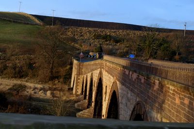
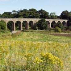
Lower North Water Bridge, Category A listed bridge in St Cyrus, Scotland

The Lower North Water Bridge is a stone arch bridge in St Cyrus that crosses the River North Esk using seven large spans. The arches are curved and the central section features triangular projections and carved details in the stonework.

Construction took place between 1770 and 1775 under the direction of engineers including John Smeaton and Andrew Barrie. This period marked a time of development in Scottish bridge building when new construction methods were being introduced.

The bridge displays Scottish building methods still visible in its stonework today, created by local craftspeople using techniques specific to the region. It connects two communities across the water and remains part of the local landscape's character.

The structure carries the A92 road, a main route connecting two regions. Visitors can view it from both banks of the river or from the roadside where the traffic passes.

Dates carved in 1774 appear beneath the central arch opening, marking the construction timeline. Memorial plaques sit on both sides of the southern railing, recording the bridge's creation.

The community of curious travelers

AroundUs brings together thousands of curated places, local tips, and hidden gems, enriched daily by 60,000 contributors worldwide.

Start exploring
Location
Location
GPS coordinates
56.75041,-2.45198
Latest update
December 14, 2025 17:41
Around this place
Links Park
United Kingdom

Links Park

4.1 km
Montrose Air Station Heritage Centre
United Kingdom

Montrose Air Station Heritage Centre

2.4 km
Stone of Morphie
United Kingdom

Stone of Morphie

947 m
North Water Viaduct
United Kingdom

North Water Viaduct

80 m
Montrose Air Station Heritage Centre
United Kingdom

Montrose Air Station Heritage Centre

2.8 km
Kinnaber, House Of Kinnaber
United Kingdom

Kinnaber, House Of Kinnaber

436 m
87-91 Murray Street, Montrose
United Kingdom

87-91 Murray Street, Montrose

4.1 km
17-19 Murray Street, Montrose
United Kingdom

17-19 Murray Street, Montrose

4 km
Montrose, High Street, Statue Of Joseph Hume
United Kingdom

Montrose, High Street, Statue Of Joseph Hume

4.4 km
Central Hotel, 118 High Street, Montrose
United Kingdom

Central Hotel, 118 High Street, Montrose

4.4 km
Royal Arch Bar, 32 High Street, Montrose
United Kingdom

Royal Arch Bar, 32 High Street, Montrose

4.3 km
St Margaret's Primary School, Blackfriars Street, Montrose
United Kingdom

St Margaret's Primary School, Blackfriars Street, Montrose

3.9 km
The Minesweeper
United Kingdom

The Minesweeper

4.3 km
Montrose, 79 High Street
United Kingdom

Montrose, 79 High Street

4.4 km
Montrose, North Esk Road, The Tower
United Kingdom

Montrose, North Esk Road, The Tower

3.5 km
North Signal Box, Montrose Station, Basin View, Montrose
United Kingdom

North Signal Box, Montrose Station, Basin View, Montrose

4.1 km
Cranes Meadow, 28 The Mall, Montrose
United Kingdom

Cranes Meadow, 28 The Mall, Montrose

3.7 km
1,3,5 High Street, Montrose
United Kingdom

1,3,5 High Street, Montrose

4.2 km
Plaque to William Lamb
United Kingdom

Plaque to William Lamb

4.2 km
Montrose, 101-103 High Street
United Kingdom

Montrose, 101-103 High Street

4.5 km
Montrose, 78, 80 High Street
United Kingdom

Montrose, 78, 80 High Street

4.4 km
Montrose, 58 High Street
United Kingdom

Montrose, 58 High Street

4.3 km
Montrose, 100-102 High Street
United Kingdom

Montrose, 100-102 High Street

4.4 km
61, 63, 65 Murray Street, Montrose
United Kingdom

61, 63, 65 Murray Street, Montrose

4.1 km
Montrose, 29 High Street
United Kingdom

Montrose, 29 High Street

4.3 km
Montrose, New Wynd, Methodist Chapel
United Kingdom

Montrose, New Wynd, Methodist Chapel

4.3 km
William Lamb Memorial Studio
United Kingdom

William Lamb Memorial Studio

4.2 km
Commemorative Plaque for 45 High Street, Montrose, Angus
United Kingdom

Commemorative Plaque for 45 High Street, Montrose, Angus

4.3 km
Show the full map
« Lower North Water Bridge - Category A listed bridge in St Cyrus, Scotland » is provided by Around Us (aroundus.com). Images and texts are derived from Wikimedia project under a Creative Commons license. You are allowed to copy, distribute, and modify copies of this page, under the conditions set by the license, as long as this note is clearly visible.

Discover hidden gems everywhere you go!

From secret cafés to breathtaking viewpoints, skip the crowded tourist spots and find places that match your style. Our app makes it easy with voice search, smart filtering, route optimization, and insider tips from travelers worldwide. Download now for the complete mobile experience.

Around Us App Screenshot

A unique approach to discovering new places

Le Figaro

All the places worth exploring

France Info

A tailor-made excursion in just a few clicks

20 Minutes

Around Us
Travel Guide & Maps
Download

Send to your phone

QR Code
1

Open the camera app on your mobile.

2

Point at the QR code with your camera. A notification will appear.

3

Tap the notification to open the link.