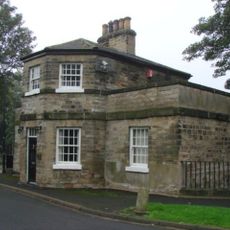
Knottingley Town Hall, Municipal hall in Knottingley, England
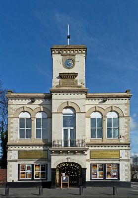
Knottingley Town Hall is a Victorian building on Weeland Road with a symmetrical facade divided into five sections, featuring an arched entrance portal and wrought iron gates at its entry. The structure was designed for public gatherings and makes use of spacious interior halls for community meetings and activities.
Construction of the building took place in 1865, funded by local businessmen led by Sidney Woolf from Ferrybridge Potteries. This civic project marked a turning point in establishing Knottingley as a proper town with its own public institution.
The first floor assembly hall serves as a gathering space where local residents come together for community events and celebrations. It remains a focal point for social connection within the town, drawing people from the surrounding area.
The building currently operates as a community center managed by volunteers, providing spaces for public gatherings and local activities. Visitors should check ahead to learn about any events or opening times available to the public.
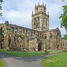
A monastery from the 7th century previously occupied the site where the town hall was later built, giving the location deep historical roots. This early religious presence shows the spot has served as an important meeting place for over a thousand years.
Location: Knottingley
Location: Wakefield
GPS coordinates: 53.70950,-1.24380
Latest update: December 14, 2025 17:43
Pontefract Castle
4.3 km
Church of All Saints
4 km
Pontefract Town Hall
4.7 km
Church of St Botolph
163 m
Micklegate Methodist Church, Pontefract
4.4 km
Church of St Mary
4 km
Church of St Edward, Brotherton
2.5 km
St Andrew's Church, Ferrybridge
2 km
Church of St Luke and All Saints
4.1 km
The Horse Vaults Public House
4.7 km
Holy Family R.C Church
4.6 km
Milestone Approximately Ten Metres North Of Junction With Byram Park Road
2.2 km
Brotherton Tubular Bridge
2.4 km
Knottingley War Memorial
57 m
Ferrybridge War Memorial
1.7 km
Brotherton Railway Bridge
2.4 km
Dandy Mill
3.4 km
Milestone Approximately Fifty Metres South Of Junction With Burton Salmon Lane
3.5 km
Ferrybridge "A" Power Station
2 km
Ferry Bridge
1.8 km
Aire bridge
4.4 km
Darrington Church Of England School
4.1 km
Old Toll House
1.9 km
Milestone, Knottingley, between two bridges over Aire & Calder Canal; opp. St Michael's Catholic Church
172 m
Stump Cross
3.1 km
Pontefract Chord Viaduct
3.5 km
Milestone, Weeland Road, E of lane to Beal opposite
3.9 km
Milestone, Church St, Brotherton
2.7 kmVisited this place? Tap the stars to rate it and share your experience / photos with the community! Try now! You can cancel it anytime.
Discover hidden gems everywhere you go!
From secret cafés to breathtaking viewpoints, skip the crowded tourist spots and find places that match your style. Our app makes it easy with voice search, smart filtering, route optimization, and insider tips from travelers worldwide. Download now for the complete mobile experience.
A unique approach to discovering new places❞
— Le Figaro
All the places worth exploring❞
— France Info
A tailor-made excursion in just a few clicks❞
— 20 Minutes