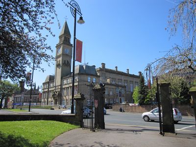
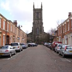
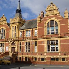
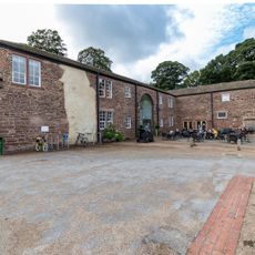
Chorley Town Hall, Victorian town hall in Chorley, England.
Chorley Town Hall is a Victorian municipal building with a symmetrical five-bay front, featuring sash windows and a prominent central entrance topped by a pediment. A clock tower rises above the entrance, anchoring the building's presence on the street.
The building was constructed in 1879 by architects John Ladds and William Henry Powell, replacing an earlier town hall dating to 1802. This reconstruction marked the town's expansion and modernization during the Victorian era.
The Lancastrian Room inside served as the heart of community life, hosting local events and civic gatherings for generations. This space reflects how residents have always thought of the building as their own gathering place.
The building sits on Market Street in the town center and is easy to reach on foot. A glass-roofed atrium added during 2005 renovations improves how visitors move through the interior spaces.
Hidden in the basement is a command center built during the 1980s as a protective shelter for local officials during potential nuclear crises. This concealed space is a reminder of Cold War tensions that once shaped civil planning.
Location: Chorley
GPS coordinates: 53.65400,-2.63320
Latest update: December 14, 2025 14:21
Preston England Temple
2.1 km
Astley Hall
1 km
St Laurence's Church, Chorley
91 m
St George's Church, Chorley
338 m
Yarrow Bridge
1.7 km
Church of St Peter
978 m
Canal Bridge Number 76
1.3 km
Park House Wesley House
375 m
Former Gateway To St Laurences Churchyard
113 m
War Memorial Gateway to Astley Park
142 m
5, Park Street
345 m
12 And 14, Park Road
366 m
The Swan With Two Necks
142 m
All Saints Church, Chorley
1.6 km
Chorley Library
380 m
Canal Bridge Number 77 (Bagganley Bridge)
1.4 km
Gateway To Roman Catholic Church Of St Mary
158 m
Drinking Fountain Circa 50 Metres South Of Stable Block To Astley Hall
1.1 km
The George
32 m
Ackhurst Lodge
1.3 km
Chorley Little Theatre
108 m
Lower Burgh Hall
2.3 km
St Peter's War Memorial, Chorley
1 km
Canal Bridge Number 75 At Sd 595 163
1.9 km
Leeds Liverpool Canal, Railway Bridge Over Leeds Liverpool Canal At Sd 595 162
1.9 km
Stable Block To Astley Hall
1.1 km
Post And Railings Protecting Raised Section Of Park Road On East Side, Extending Circa 80 Metres From Junction With Church Brow
107 m
The Manor House
126 mVisited this place? Tap the stars to rate it and share your experience / photos with the community! Try now! You can cancel it anytime.
Discover hidden gems everywhere you go!
From secret cafés to breathtaking viewpoints, skip the crowded tourist spots and find places that match your style. Our app makes it easy with voice search, smart filtering, route optimization, and insider tips from travelers worldwide. Download now for the complete mobile experience.
A unique approach to discovering new places❞
— Le Figaro
All the places worth exploring❞
— France Info
A tailor-made excursion in just a few clicks❞
— 20 Minutes