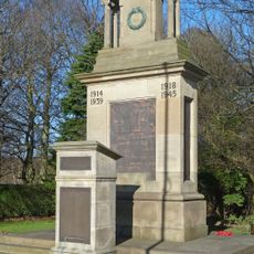
Horsforth Hall Park, Neighborhood park in Horsforth, England.
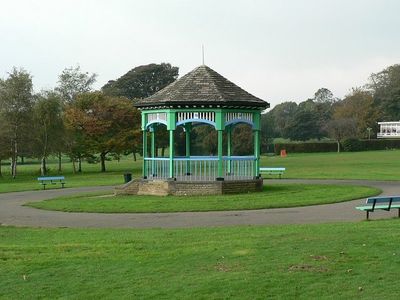
Horsforth Hall Park is a neighborhood park spanning about 3.4 hectares with distinct areas for various activities across the site. The grounds include open green spaces, a cricket pitch, a bowling green, a children's adventure playground, and a bandstand for outdoor performances.
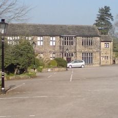
The park developed from Horsforth Hall, a residence built in 1699 that remained with the Stanhope family for generations. In 1930, William Mathieson acquired the property and donated it to the local council, leading to its conversion into a public park for community use.
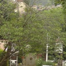
The park features a Japanese Garden that blends Asian design principles with the traditional English park layout, creating a distinct cultural marker within the local community. This section draws visitors seeking a quieter experience different from the main recreational areas.
The main entrance on Hall Lane offers two accessible parking spaces for disabled visitors, and all park paths are fully wheelchair accessible throughout. Walking shoes are useful for exploring the different zones, and you will find seating areas scattered across the grounds for rest stops.
The children's play area features specially designed equipment that allows children under eight of all physical abilities to play together without barriers. This approach to play design means kids with different needs can share the same space and activities.
Location: Horsforth
Address: Horsforth Hall Park, Hall Lane, Horsforth, Leeds, LS18 5JE
Website: https://leeds.gov.uk/leisure/parks-and-countryside/your-local-park/horsforth-hall-park
GPS coordinates: 53.83757,-1.64824
Latest update: December 14, 2025 13:07
Grove Methodist Church
480 m
Church of St Margaret
462 m
Low Hall Restaurant And Farmhouse
1.1 km
Abbey Inn
1.4 km
Horsforth Library
735 m
Bridge Over River Aire
1.5 km
2,6 And 8, Bachelor Lane
950 m
Newlay Bridge
1.2 km
Low Fold
457 m
Horsforth War Memorial
370 m
Croft House
885 m
Upper Bank House
427 m
K6 Telephone Kiosk Adjacent To The Old Kings Arms Public House
372 m
Stanhope Drive War Memorial
1 km
Lee Lane Farmhouse
1 km
Grove Manse
452 m
79,81 And 83, Town Street
575 m
Troy Hill
1.4 km
Toll House To Iron Bridge
1.2 km
Weir And Retaining Walls On River Aire
1.2 km
4, Hall Lane
291 m
Stable Block To Former Horsforth Hall
118 m
123-135, Town Street
776 m
6, Hall Lane
273 m
Gritstone pillar with three cup marks in the north pavement of the A65 at Horsforth, 440m south east of the roundabout at Low Fold
587 m
Milestone, New Road Side, Horsforth
595 m
Milestone, Rawdon Road, N of Ring Road A6120
1.1 km
Baptist Sunday School And Attached House
931 mVisited this place? Tap the stars to rate it and share your experience / photos with the community! Try now! You can cancel it anytime.
Discover hidden gems everywhere you go!
From secret cafés to breathtaking viewpoints, skip the crowded tourist spots and find places that match your style. Our app makes it easy with voice search, smart filtering, route optimization, and insider tips from travelers worldwide. Download now for the complete mobile experience.
A unique approach to discovering new places❞
— Le Figaro
All the places worth exploring❞
— France Info
A tailor-made excursion in just a few clicks❞
— 20 Minutes