Enable Location

We need your location to show you interesting places around you

Discover nearby places

Find interesting locations and hidden gems around you

Precise directions

Get accurate directions and distances to places

Your location is never shared with other users. It's only used when you tap the location button.

Horsforth

Log in to your account

Start exploring — it's free

Trusted by 62,937 travelers worldwide

Continue with Google
Continue with Apple
or

We will send you a code to connect

By continuing, you accept our Terms and Conditions and our Privacy Policy

Check your inbox

We've sent a pincode in your inbox. Please enter the code below.

Discussion Reviews 1 Photos
30.2k Popularity

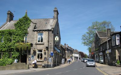
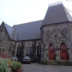
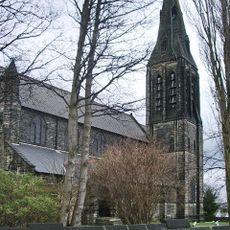
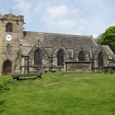
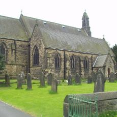
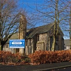
Horsforth, Civil parish and town in Leeds, England.

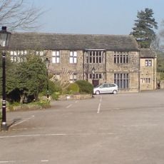
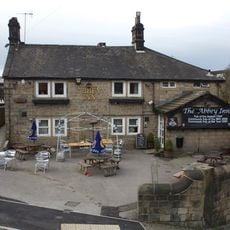
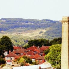
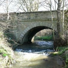
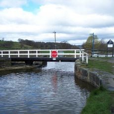
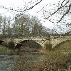
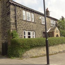
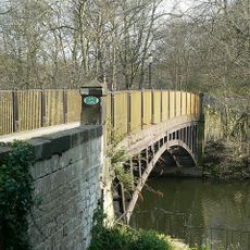
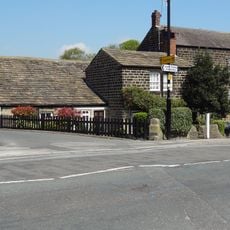
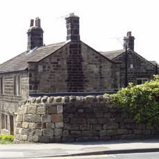
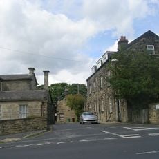
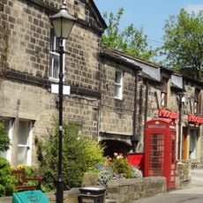
Horsforth is a residential town in northwestern Leeds with stone buildings, green spaces, and the River Aire flowing through its boundaries. The area is shaped by Leeds Trinity University, which brings educational facilities and an academic character to the place.

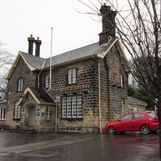
The name appears in the Domesday Book of 1086 as Horseford, meaning a ford for horses over the River Aire in Old English terms. During industrialization, the area gained importance as local quarries supplied sandstone for various building projects across the region.

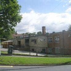
Leeds Trinity University campus occupies a substantial portion of the town, bringing an educational influence to the local community of 20,922 residents.

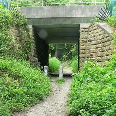
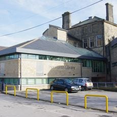
The town is well connected via Horsforth railway station to Leeds and Harrogate, and several bus routes serve neighboring areas. Visitors can explore green spaces along the Aire and easily find educational facilities scattered across the town.

Local quarries supplied sandstone for Scarborough's seafront and other historic structures across the industrial region. This legacy shows how smaller towns shaped development in larger cities through their natural resources.

The community of curious travelers

AroundUs brings together thousands of curated places, local tips, and hidden gems, enriched daily by 60,000 contributors worldwide.

Start exploring
Location
GPS coordinates
53.83413,-1.64288
Latest update
December 20, 2025 02:35
Around this place
Horsforth Golf Club
United Kingdom

Horsforth Golf Club

2.1 km
Horsforth Hall Park
United Kingdom

Horsforth Hall Park

520 m
Grove Methodist Church
United Kingdom

Grove Methodist Church

342 m
Church of St Margaret
United Kingdom

Church of St Margaret

664 m
Church of St Peter
United Kingdom

Church of St Peter

2.3 km
Low Hall Restaurant And Farmhouse
United Kingdom

Low Hall Restaurant And Farmhouse

1.3 km
Church of St James
United Kingdom

Church of St James

1.3 km
Church of St Mary
United Kingdom

Church of St Mary

1.7 km
Fox And Hounds Public House
United Kingdom

Fox And Hounds Public House

1.9 km
Daffy Wood
United Kingdom

Daffy Wood

1.7 km
United Kingdom

Group Of 4 Hardaker And Booth Monuments Approximately 1 Metre East Of East Wall Of Chancel Of Church Of St Peter

2.3 km
United Kingdom

Group Of 3 Hird Monuments Approximately 3 Metres South East Of Chancel Of Church Of St Peter

2.3 km
Horsforth Library
United Kingdom

Horsforth Library

728 m
Abbey Inn
United Kingdom

Abbey Inn

891 m
Clayton Wood
United Kingdom

Clayton Wood

2 km
Bridge Over Moseley Beck
United Kingdom

Bridge Over Moseley Beck

1.7 km
Leeds And Liverpool Canal, Owl Bridge
United Kingdom

Leeds And Liverpool Canal, Owl Bridge

1.7 km
Bridge Over River Aire
United Kingdom

Bridge Over River Aire

1.6 km
2,6 And 8, Bachelor Lane
United Kingdom

2,6 And 8, Bachelor Lane

962 m
Newlay Bridge
United Kingdom

Newlay Bridge

714 m
Station House With Horsforth Pottery And Barn (Both Attached)
United Kingdom

Station House With Horsforth Pottery And Barn (Both Attached)

1.7 km
Low Fold
United Kingdom

Low Fold

391 m
Tinshill and Cookridge Social Club
United Kingdom

Tinshill and Cookridge Social Club

1.7 km
United Kingdom

Foster Monument Approximately 1 Metre South Of East Bay Of Chancel Of Church Of St Peter

2.3 km
Horsforth War Memorial
United Kingdom

Horsforth War Memorial

194 m
Upper Bank House
United Kingdom

Upper Bank House

225 m
Stanhope Drive War Memorial
United Kingdom

Stanhope Drive War Memorial

791 m
K6 Telephone Kiosk Adjacent To The Old Kings Arms Public House
United Kingdom

K6 Telephone Kiosk Adjacent To The Old Kings Arms Public House

291 m
Show the full map
Reviews
Share your experience

No review yet

Discussions
Start a discussion...

No discussion yet

« Horsforth - Civil parish and town in Leeds, England » is provided by Around Us (aroundus.com). Images and texts are derived from Wikimedia project under a Creative Commons license. You are allowed to copy, distribute, and modify copies of this page, under the conditions set by the license, as long as this note is clearly visible.

Discover hidden gems everywhere you go!

From secret cafés to breathtaking viewpoints, skip the crowded tourist spots and find places that match your style. Our app makes it easy with voice search, smart filtering, route optimization, and insider tips from travelers worldwide. Download now for the complete mobile experience.

Around Us App Screenshot

A unique approach to discovering new places

Le Figaro

All the places worth exploring

France Info

A tailor-made excursion in just a few clicks

20 Minutes

Around Us
Travel Guide & Maps
Download

Send to your phone

QR Code
1

Open the camera app on your mobile.

2

Point at the QR code with your camera. A notification will appear.

3

Tap the notification to open the link.