Enable Location

We need your location to show you interesting places around you

Discover nearby places

Find interesting locations and hidden gems around you

Precise directions

Get accurate directions and distances to places

Your location is never shared with other users. It's only used when you tap the location button.

Log in to your account

Start exploring — it's free

Trusted by 63,108 travelers worldwide

Continue with Google
Continue with Apple
or

We will send you a code to connect

By continuing, you accept our Terms and Conditions and our Privacy Policy

Check your inbox

We've sent a pincode in your inbox. Please enter the code below.

Takadate yama
Discussion Reviews Photo
4.3k Popularity

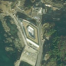
Takadate yama, Mountain summit in Tsuruoka, Japan

Takadate yama is a mountain in the Tsuruoka area featuring two lakes, Shimo-ike and Kami-ike, that form a wetland ecosystem near its base. Hiking trails connect the summit to surrounding forest and wetland habitats, creating a varied landscape for visitors to explore.

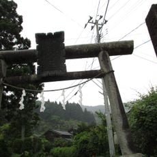
The mountain includes a historic trail that follows the route taken by the renowned Japanese poet Matsuo Basho during his travels through northern Japan in the 17th century. This walking path has been preserved and remains a connection to that period of literary exploration.

The area holds meaning for people interested in classical Japanese poetry and literary travel, drawing visitors who follow in the footsteps of famous travelers from past centuries. The surrounding communities maintain seasonal traditions that connect the place to local life and regional customs.

The mountain is accessible from the Hotoria Nature Centre, where visitors can gather information about local wildlife and available hiking routes before starting their walk. Proper footwear and weather-appropriate clothing are important since conditions on the mountain vary throughout the year.

The mountain is home to one of Japan's officially designated wetlands under the Ramsar Convention, making it an important site for birdwatchers throughout the year. Migratory birds rely on these lakes as stopover points during their journeys across the region.

The community of curious travelers

AroundUs brings together thousands of curated places, local tips, and hidden gems, enriched daily by 60,000 contributors worldwide.

Start exploring
Elevation above the sea
273.2 m
GPS coordinates
38.76293,139.74749
Latest update
December 11, 2025 11:03
Reviews
Share your experience

No review yet

Discussions
Start a discussion...

No discussion yet

« Takadate yama - Mountain summit in Tsuruoka, Japan » is provided by Around Us (aroundus.com). Images and texts are derived from Wikimedia project under a Creative Commons license. You are allowed to copy, distribute, and modify copies of this page, under the conditions set by the license, as long as this note is clearly visible.

Discover hidden gems everywhere you go!

From secret cafés to breathtaking viewpoints, skip the crowded tourist spots and find places that match your style. Our app makes it easy with voice search, smart filtering, route optimization, and insider tips from travelers worldwide. Download now for the complete mobile experience.

Around Us App Screenshot

A unique approach to discovering new places

Le Figaro

All the places worth exploring

France Info

A tailor-made excursion in just a few clicks

20 Minutes

Around Us
Travel Guide & Maps
Download

Send to your phone

QR Code
1

Open the camera app on your mobile.

2

Point at the QR code with your camera. A notification will appear.

3

Tap the notification to open the link.