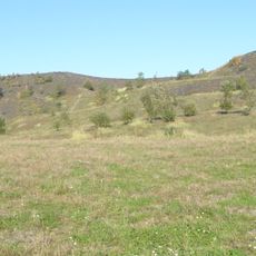
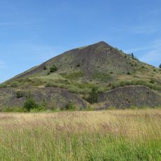
Summit, scenic viewpoint, Summit viewpoint in Oignies, France.
This elevated viewpoint offers views across the wide landscape of the Nord-Pas-de-Calais region and neighboring municipalities. From here, one can see the topography of the area and the spread of surrounding villages across the horizon.
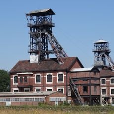
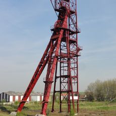
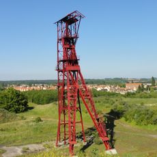
The location served as a geographical reference point for mining operations that shaped northern industry in the 19th century. The site helped workers and authorities manage and monitor the extensive extraction areas across the region.
The viewpoint is a popular gathering place for local residents during regional celebrations and fireworks over the former mining area. People come here to watch events together and enjoy the expansive views across the landscape.
The viewpoint is accessible via a maintained pathway that connects to the main road through Oignies and is easy to locate. Wear sturdy footwear and be prepared for changing weather, as the elevation can intensify wind conditions.
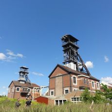
From here, the remains of former mining installations are visible, which once defined the region's economy. These ruins tell the story of how industry transformed the landscape and stand today as silent reminders of that era.
Location: Oignies
GPS coordinates: 50.46014,2.98422
Latest update: December 15, 2025 13:21
Fosse n° 9 - 9 bis des mines de Dourges
209 m
Fosse n° 2 des mines d'Ostricourt
1.7 km
Église Saint-Joseph d'Oignies
2.4 km
Église Saint-Barthélémy d'Oignies
968 m
Église Saint-Stanislas de Dourges
3.2 km
Hôtel de ville de Carvin
3.9 km
Fosse n° 8 - 8 bis des mines de Dourges
3.6 km
Dourges German military cemetery
2.4 km
Monument aux morts de Dourges
2.4 km
Église Saint-Henri de Libercourt
2.9 km
Église Saint-Piat de Dourges
2.8 km
Église Saint-Piat
2.6 km
Église Saint-Martin de Noyelles-Godault
4.3 km
Église Saint-Druon de Carvin
4.1 km
Église Saint-Vaast d'Ostricourt
3.6 km
Monument de la Découverte du Charbon
891 m
Église Notre-Dame de Libercourt
3.6 km
Église Saint-Jacques d'Ostricourt
3.2 km
Chapelle Sainte-Thérèse-de-l'Enfant-Jésus de Courrières
2.9 km
Paysage et ensemble miniers de Libercourt
2.4 km
Église Sainte-Barbe de Carvin
3.4 km
Église de la cité Saint-Paul de Carvin
4.2 km
Cité Foch
4.2 km
Ancienne Fosse n°2 et mine-image
1.8 km
Spoil tips 87 and 92
4 km
Paysage et ensemble miniers de la fosse n°9-9bis
535 m
Ensemble minier de la fosse Cornuault
3.7 km
Monument aux morts de Noyelles-Godault
4.3 kmVisited this place? Tap the stars to rate it and share your experience / photos with the community! Try now! You can cancel it anytime.
Discover hidden gems everywhere you go!
From secret cafés to breathtaking viewpoints, skip the crowded tourist spots and find places that match your style. Our app makes it easy with voice search, smart filtering, route optimization, and insider tips from travelers worldwide. Download now for the complete mobile experience.
A unique approach to discovering new places❞
— Le Figaro
All the places worth exploring❞
— France Info
A tailor-made excursion in just a few clicks❞
— 20 Minutes