Drinking fountain, water well
Location: Nissan-lez-Enserune
GPS coordinates: 43.31028,3.11352
Latest update: November 14, 2025 17:35
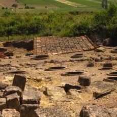
Oppidum d'Ensérune
248 m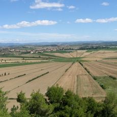
Pond of Montady
1.2 km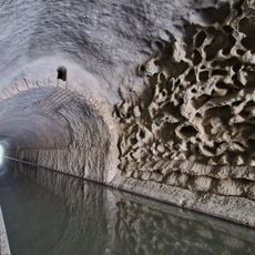
Malpas Tunnel
1.1 km
Étang de Capestang
5.2 km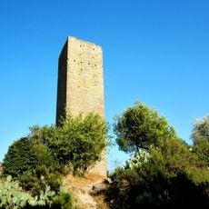
Tour de Montady
2.2 km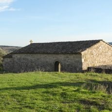
Chapelle Saint-Christol de Nissan-lez-Enserune
4.5 km
Château de la Tour
3.8 km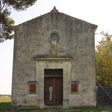
Chapelle Notre-Dame-de-la-Miséricorde de Nissan-lez-Enserune
2.4 km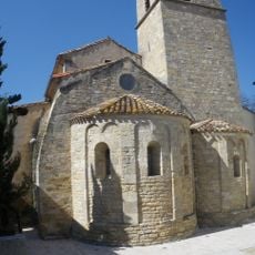
Église Saint-Sylvestre-et-Sainte-Colombe de Colombiers
2.1 km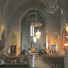
Église Saint-Saturnin
2.3 km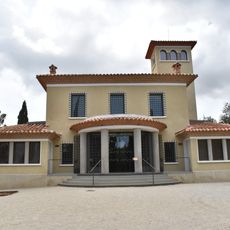
Ensérune museum
21 m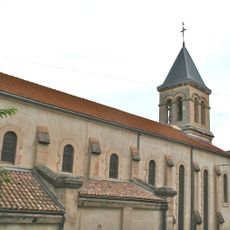
Église Saint-Geniès de Montady
2.3 km
Orgue de tribune de l'église Saint-Saturnin de Nissan-lez-Enserune
2.3 km
Domaine de Régismont
1.2 km
Autel de Malpas
2.2 km
Scenic viewpoint
417 m
Vue sur l'étang de Montady et sur l'oppidum d'ensérune
2.2 km
Point de vue sur l'étang de Montady
62 m
Scenic viewpoint
278 m
Vélorail du Canal du Midi
2.4 km
Salle Michel Galabru
3 km
Moulin de Tiquet
3.6 km
Windmill
3.5 km
Wayside cross
3.4 km
Wayside cross
2.1 km
Wayside cross
5 km
Wayside cross
2.3 km
Memorial, stele
2.9 kmReviews
Visited this place? Tap the stars to rate it and share your experience / photos with the community! Try now! You can cancel it anytime.
Discover hidden gems everywhere you go!
From secret cafés to breathtaking viewpoints, skip the crowded tourist spots and find places that match your style. Our app makes it easy with voice search, smart filtering, route optimization, and insider tips from travelers worldwide. Download now for the complete mobile experience.

A unique approach to discovering new places❞
— Le Figaro
All the places worth exploring❞
— France Info
A tailor-made excursion in just a few clicks❞
— 20 Minutes