Pond of Montady, Medieval drained wetland in Hérault, France.
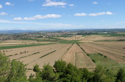
The Pond of Montady is a former wetland in Hérault that was drained through a network of straight channels radiating from a central point. These channels divide the 420 hectare area into triangular agricultural plots that remain visible today.
In 1247, monks and landowners from Béziers received permission from the Archbishop of Narbonne to drain the brackish marsh. This drainage project transformed the unsuitable swamp into productive farmland over the following decades.
The radial ditch pattern reflects medieval engineering that shaped how people used and understood this land for farming. Today, walking through or viewing this area shows how water control became central to the region's agricultural identity.
The best view of the geometric field pattern is from the Oppidum d'Ensérune archaeological site, situated on higher ground overlooking the drained area. This elevated vantage point allows visitors to see the full radial design and understand the engineering work involved.
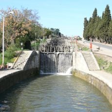
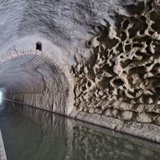
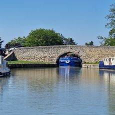
Water from this drained land flows through an underground tunnel beneath Malpas hill and eventually connects to the Canal du Midi. This hidden link joins the medieval drainage system to one of Europe's most famous waterways, built in the 1600s.
The community of curious travelers
AroundUs brings together thousands of curated places, local tips, and hidden gems, enriched daily by 60,000 contributors worldwide.