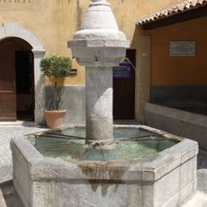
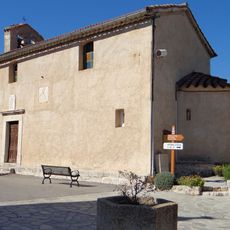
Clue d'Aiglun, Canyoning site in Sallagriffon, France
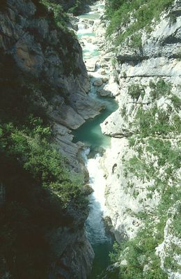
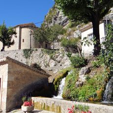
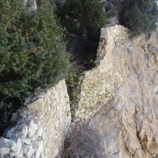
The Clue d'Aiglun canyon stretches 1500 meters with an 80-meter height difference, featuring the Esteron river flowing through limestone formations in the Alpes Maritimes.
The canyon became an established sports venue in 1928, marking the beginning of organized canyoning activities in the Alpes Maritimes region of southeastern France.
The canyon maintains strict safety protocols, requiring participants to meet age and physical requirements while following local water sports traditions of the French Alps.
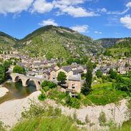
Access to the canyon requires a 45-minute hike from the meeting point at Aiglun bridge, and participants need swimming attire plus athletic shoes for the 4-hour adventure.
The canyon contains multiple water-filled passages requiring mandatory 3-meter jumps and includes sections with natural siphons formed by the continuous water flow.
Location: Sallagriffon
Inception: 1928
Address: Gorges de l'Estéron 06910 Sallagriffon
GPS coordinates: 43.87225,6.90491
Latest update: March 5, 2025 22:18
France's landscape features a variety of natural canyons carved by river erosion over millennia. These geological formations include the white limestone walls of Verdon, the red shale cliffs of Daluis Canyon, and the emerald waters of Ardèche. Each site reflects a unique geological history, with depths ranging from a few tens of meters to over 700 meters. The Tarn gorges stretch 50 kilometers between the Causses, while Verdon has created Europe's deepest canyon. In the Pyrenees, the Gorges de la Carança and Gorges de la Fou offer pathways with metal walkways. The Alps host the Aiglun Gorge and Daluis Gorges, recognizable by their Permian red rocks. These natural sites are suitable for hiking, climbing, kayaking, and feature many viewpoints to observe these rock formations from nearby roads.
Montagne du Cheiron
8.2 km
Réserve biologique des monts d'azur
8.8 km
Borne milliaire de Gréolières
8.9 km
Chapelle Saint-Étienne de Gréolières
8.8 km
Église Sainte-Pétronille de Roquestéron-Grasse
8 km
Église Saint-Michel de Sigale
4.8 km
Fontaine de Sigale
4.8 km
Église Saint-Sauveur de Gars
8.2 km
Église Notre-Dame du Mas
4.9 km
Chapelle Notre-Dame-d'Entrevignes de Sigale
6.6 km
Chapelle Saint-Joseph de Gars
7.4 km
Église Saint-Pierre de La Penne
7.1 km
Église Sainte-Arige de Roquestéron
8.1 km
Église Saint-Étienne de Saint-Pierre
4.7 km
Église Saint-Roch de Collongues
3.8 km
Église Sainte-Marguerite de Sallagriffon
1.3 km
Chapelle Saint-Jeannet d'Amirat
7.8 km
Église Sainte-Anne d'Amirat
6.9 km
Église Saint-Raphaël d'Aiglun
1.8 km
Cime de la Cacia
4.8 km
Église Sainte-Marthe des Mujouls
3.8 km
Forteresse troglodyte d'Aiglun
1.1 km
Chapelle Notre-Dame-du-Plan dite Halte des Templiers de La Penne
7 km
Chapelle Saint-Pierre de Saint-Pierre
4.7 km
Chapelle Sainte-Pétronille de Gréolières
8.7 km
Chapelle de Saint-Saturnin
6.3 km
Chapelle Saint-Arnoux du Mas
5 km
Chapelle d'Avenos
7.3 kmReviews
Visited this place? Tap the stars to rate it and share your experience / photos with the community! Try now! You can cancel it anytime.
Discover hidden gems everywhere you go!
From secret cafés to breathtaking viewpoints, skip the crowded tourist spots and find places that match your style. Our app makes it easy with voice search, smart filtering, route optimization, and insider tips from travelers worldwide. Download now for the complete mobile experience.
A unique approach to discovering new places❞
— Le Figaro
All the places worth exploring❞
— France Info
A tailor-made excursion in just a few clicks❞
— 20 Minutes