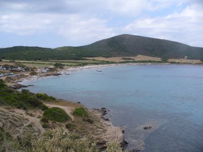
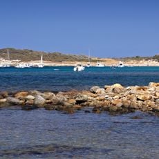
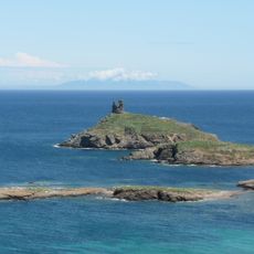
Plage de Tamarone, Mediterranean beach in Cap Corse, France
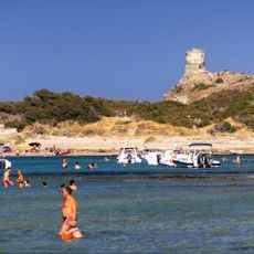
Plage de Tamarone is a beach on the Tyrrhenian coast with pale sand and natural rock formations at either end. The bay curves gently and offers sheltered swimming conditions protected by the headlands.
The bay served ancient Roman vessels as a sheltered stopping point during their Mediterranean journeys, when ships needed protection from open water. This maritime role has shaped the place for thousands of years.
Local fishermen work from this shoreline using traditional methods, launching small boats directly into the water each morning. The practice shapes daily life here and shows how communities have relied on the bay for generations.
Access is via a dirt road from Macinaggio village, with parking near the shore at the journey's end. Bring plenty of water and sun protection, as the approach lacks shade and the sun reflects strongly off the sand.
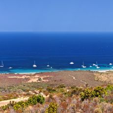
The beach sits at the edge of a protected natural area where dense scrubland grows with aromatic plants found nowhere else. This vegetation adds a distinct scent to the place and draws rare bird species to visit throughout the year.
Location: Corsica
GPS coordinates: 42.97543,9.45473
Latest update: December 6, 2025 19:04
The Corsican coastline extends over 1,000 kilometers and features numerous sandy beaches, rocky coves and marine reserves. The waters around Porto-Vecchio in the southeast of the island display fine white sand and turquoise water. The Bonifacio region presents limestone cliffs and sheltered bays, while beaches near Calvi on the northwest coast are bordered by pine forests. The eastern shore between Bastia and Solenzara offers long sandy beaches with shallow access to the sea. The western coast reveals granite formations and small coves between Piana and Scandola. Cap Corse in the north provides pebble beaches and rocky sections. Water temperatures reach 24 to 26 degrees Celsius during summer, while the swimming season runs from June to September.
Torra di Santa Maria Chjapella
1.7 km
Réserve naturelle des îles du Cap Corse
1.5 km
Acqua Tignese
5.3 km
Torra di Meria
4.6 km
Torra d'Agnello
4.4 km
Torra di Finochjarola
1.7 km
Chapelle de confrérie Santa Croce de Rogliano
3.6 km
Torra di Tòllari
6.6 km
Cala beach
4.8 km
Église Sant'Agnello de Rogliano
3.8 km
Église Saint-André d'Ersa
5.4 km
Église San Nicolao de Tomino
3.5 km
Église Santa Maria Assunta di a Chjapella
1.2 km
Ancien couvent Santa Maria Nativita d'Ersa
6.3 km
Cala beach
4.8 km
Scenic viewpoint
978 m
Chapelle San Marcu à Macinaggio
1.8 km
Couvent Saint-François de Rogliano
4 km
Église Santa Chiara de Rogliano
4.3 km
Chapelle Saint-Pierre de Barcaggio à Ersa
5.4 km
Chapelle San Roccu à Quercioli
3.7 km
Chapelle Saint-Jean-Baptiste d'Ersa
6 km
Chapelle Sant'Antonio de Tomino
3.7 km
Ancienne chapelle Saint-Nicolas d'Ersa
5.3 km
Castello San Colombano
4.5 km
Chapelle Saint-Roch de Tomino
3.3 km
Tour della Parocchia
3.7 kmReviews
Visited this place? Tap the stars to rate it and share your experience / photos with the community! Try now! You can cancel it anytime.
Discover hidden gems everywhere you go!
From secret cafés to breathtaking viewpoints, skip the crowded tourist spots and find places that match your style. Our app makes it easy with voice search, smart filtering, route optimization, and insider tips from travelers worldwide. Download now for the complete mobile experience.
A unique approach to discovering new places❞
— Le Figaro
All the places worth exploring❞
— France Info
A tailor-made excursion in just a few clicks❞
— 20 Minutes