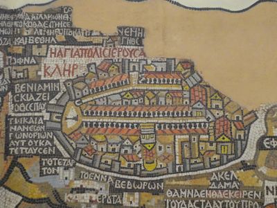
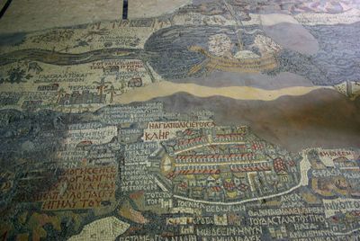
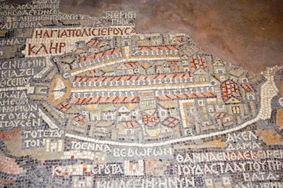
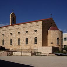
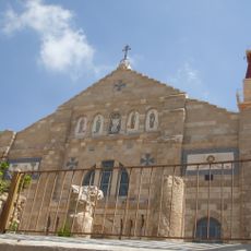
Madaba Map, Geographic floor mosaic in Saint George Church, Madaba, Jordan
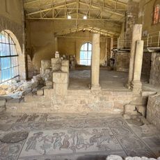
The Madaba Map is a large mosaic made of tiny colored stones depicting the Middle East region from the north to Egypt and showing historical cities, rivers, and important religious locations. The work covers a significant area of the church floor and shows in detail how this region appeared in ancient times, with clear depictions of towns and geographical features.
The mosaic was created in the 6th century CE and is one of the oldest known cartographic representations of the Palestine region and Jerusalem. It documents how the Byzantine world understood and depicted this area before it was later damaged and only partially preserved.
The map shows Jerusalem as it appeared under Byzantine rule, with recognizable locations like churches and gates that help visitors understand the city as people knew it then. The way these places are arranged gives a sense of how people in the 6th century perceived and organized knowledge of their sacred landscape.
The mosaic sits on the floor of Saint George Church, where it is directly visible under the feet of visitors and easily accessible. It's best to take time and look from different positions to really understand the various areas and details.
The map shows fish swimming in the Jordan River but turning away from the Dead Sea, revealing that the artist understood the natural behavior of these waters. This surprising detail from ancient times shows that the creator made careful observations about how these specific locations actually worked.
The community of curious travelers
AroundUs brings together thousands of curated places, local tips, and hidden gems, enriched daily by 60,000 contributors worldwide.