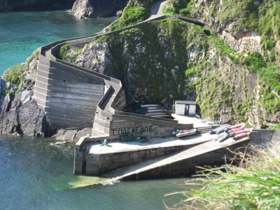
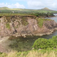
Dún Chaoin pier, Harbor on the western edge of Dingle Peninsula, Ireland
Dún Chaoin is a harbor on the western edge of the Dingle Peninsula featuring a narrow concrete path that winds steeply down cliffs to a small dock at sea level. The walkway connects the mainland directly to the pier situated on the water below.
The pier served as a vital transportation route during the twentieth century for moving sheep between the Blasket Islands and the mainland. This connection was essential to the island communities' economy and way of life.
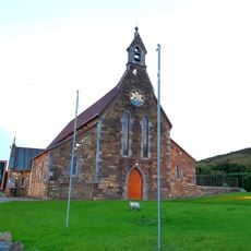
The pier sits in a Gaeltacht region where residents speak Irish as their main language and maintain traditional fishing practices. This harbor serves as a gathering point for the community and shows how central the sea remains to local life.
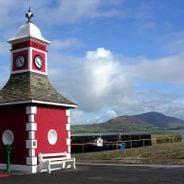
Visitors must park their vehicles in the designated area near the ticket office, as the steep path allows only pedestrian access. The narrow concrete walkway requires careful footing, especially during wet conditions.
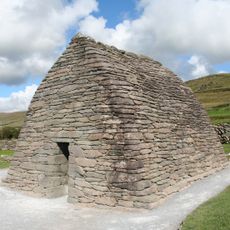
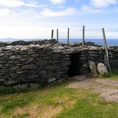
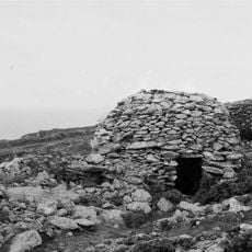
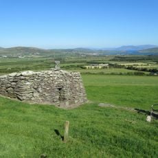
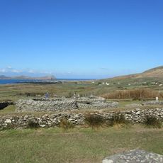
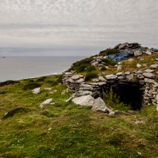
The pier serves as the departure point for ferries to the Great Blasket Island, where abandoned stone cottages reveal stories of former inhabitants. Visitors can explore these ruins and understand how island communities once lived in this remote location.
Location: Dunquin
GPS coordinates: 52.12416,-10.46044
Latest update: December 6, 2025 19:07
Ireland presents a range of natural landscapes and historic sites spread across the entire country. This collection guides you to coastal cliffs, mountain ranges, medieval castles, and lighthouses that reflect Ireland's history and natural environment. You will explore places like Glendalough Valley...
Gallarus Oratory
9.3 km
Dunbeg Fort
4.2 km
Reask
6.9 km
Kilmalkedar
10.8 km
Rahinnane Castle
5.7 km
Gallarus Castle
9.2 km
Glanfahan
3.2 km
Temple-Managhan
9.4 km
Caherdorgan North
10.3 km
Coumeenoole North/Com Dhíneol Thuaidh
1.6 km
Oghamsteine von Coláiste Íde
10.5 km
Ballinrannig Stone
7.8 km
St. Brendan's Oratory
10.7 km
Dunurlin Graveyard
5.7 km
Dunquin Old Church
1.4 km
Kilmalkedar Church
10.8 km
Ballywiheen Church
6 km
Ventry Graveyard
5.6 km
CIIC 178
1.8 km
178 (Ogham Stone Concept by the Research Squirrel Ogham Project)
1.8 km
178. Coumeenole (Ogham Stone Concept by the Ogham in 3D Project)
1.8 km
Inishtooskert Early Medieval Ecclesiastical Site
8.7 km
COUME/1 (Ogham Stone Concept by CISP)
1.5 km
St Vincent's Church
6 km
Dún an Óir
8 km
Séipéal Chaitlín Naofa
5.5 km
Coumeenoole Stone
1.8 km
Kilmalkedar Sun Dial
10.8 kmVisited this place? Tap the stars to rate it and share your experience / photos with the community! Try now! You can cancel it anytime.
Discover hidden gems everywhere you go!
From secret cafés to breathtaking viewpoints, skip the crowded tourist spots and find places that match your style. Our app makes it easy with voice search, smart filtering, route optimization, and insider tips from travelers worldwide. Download now for the complete mobile experience.
A unique approach to discovering new places❞
— Le Figaro
All the places worth exploring❞
— France Info
A tailor-made excursion in just a few clicks❞
— 20 Minutes