Keilor Public Driving Range
Location: Keilor North
Location: Melbourne
Operator: Brimbank City Council
GPS coordinates: -37.68293,144.79337
Latest update: November 22, 2025 18:10
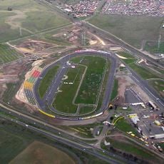
Calder Park Raceway
3.5 km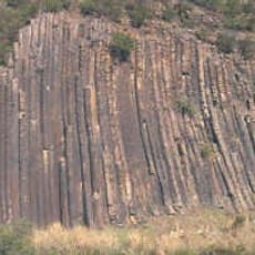
Organ Pipes National Park
2.8 km
Keilor archaeological site
4.6 km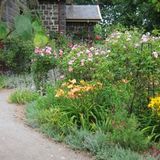
Alister Clark Memorial Rose Garden
5.2 km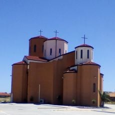
Macedonian Orthodox Cathedral of the Dormition of the Virgin Mary, Sydenham
2.9 km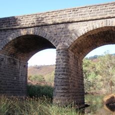
Bulla Bridge
5.8 km
Green Gully archaeological site
6 km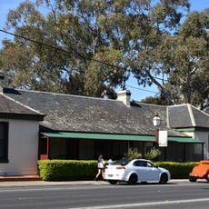
Keilor Hotel
5.6 km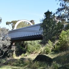
Old Iron Bridge, Keilor
6.1 km
Caroline Chisholm Park
5.8 km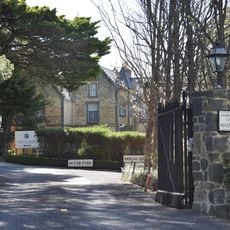
Overnewton
3.4 km
Overnewton Gatehouse
3.8 km
Former State School No.46
5.2 km
Trestle Bridge
4.2 km
Glenara
4.6 km
Prefabricated Building
1.4 km
Keilor Public Golf Course
308 m
Melbourne Airport Golf Club
4 km
Houdini Aircraft
2.9 km
Sydenham Memorial Mural
2.5 km
Levelled Crossing
2.5 km
Eel Dance
2.2 km
Statue, Work of art
6.2 km
Work of art, sculpture
2.5 km
Organ Pipes
2.8 km
Tesselated Pavement
3.2 km
Rosette Rock
3.1 km
Scenic viewpoint
2.7 kmReviews
Visited this place? Tap the stars to rate it and share your experience / photos with the community! Try now! You can cancel it anytime.
Discover hidden gems everywhere you go!
From secret cafés to breathtaking viewpoints, skip the crowded tourist spots and find places that match your style. Our app makes it easy with voice search, smart filtering, route optimization, and insider tips from travelers worldwide. Download now for the complete mobile experience.

A unique approach to discovering new places❞
— Le Figaro
All the places worth exploring❞
— France Info
A tailor-made excursion in just a few clicks❞
— 20 Minutes