Golf Sankt Urbanus, V-Golf
Location: Lülsdorf
Location: Niederkassel
GPS coordinates: 50.84992,7.06310
Latest update: November 30, 2025 09:34
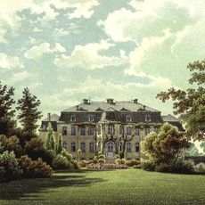
Schloss Wahn
1.7 km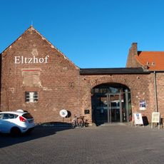
Eltzhof
1.6 km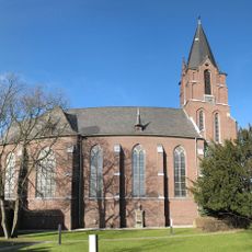
St. Ägidius
1.8 km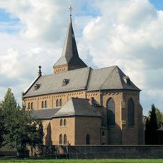
St. Margaretha
1.5 km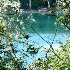
Kiesgruben Paulsmaar
1 km
LSG-Freiraeume um Zuendorf, Wahn, Libur, Lind und Langel rechtsrheinisch
257 m
Weilerhofer See
1.5 km
Bröhls Kreuz
1.5 km
Kriegsgräber
2 km
Scenic viewpoint
1.8 km
Scenic viewpoint
1.4 km
Hölser Kreuz
1.8 km
Wayside cross
1.7 km
Wayside shrine, Christianity
1.4 km
Wahnbad
2.4 km
Wayside cross
1.5 km
Wayside cross
1.7 km
Christianity, wayside cross
2.3 km
Gut Eltzhof / Theatermuseum
1.6 km
Wayside cross
1.4 km
Wayside cross
1.9 km
Christianity, wayside shrine
2.3 km
Urbanuskreuz
620 m
Stompeler Kreuz
1.1 km
Wayside cross
1.8 km
Henriette Cahn
2.4 km
Wayside cross
2.4 km
Catholic church building, wayside cross, Christianity
1.5 kmReviews
Visited this place? Tap the stars to rate it and share your experience / photos with the community! Try now! You can cancel it anytime.
Discover hidden gems everywhere you go!
From secret cafés to breathtaking viewpoints, skip the crowded tourist spots and find places that match your style. Our app makes it easy with voice search, smart filtering, route optimization, and insider tips from travelers worldwide. Download now for the complete mobile experience.

A unique approach to discovering new places❞
— Le Figaro
All the places worth exploring❞
— France Info
A tailor-made excursion in just a few clicks❞
— 20 Minutes