Erg de Ouzina
Location: Et-taous ⵟⴰⵡⵙ الطاوس
GPS coordinates: 30.78478,-4.18992
Latest update: October 15, 2025 21:42

Sijilmasa
55.8 km
Gara Medouar
60.9 km
Dadès Gorges
185.5 km
Todgha Gorge
155.9 km
Priory of Our Lady of Atlas
217.2 km
Fezouata formation
146 km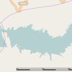
Hassan II Dam
230 km
Haut Atlas Oriental National Park
200.4 km
Site of Aït Ouaazik
121.7 km
Chapelle de Charles de Foucauld
207.7 km
Oasis du Sud Marocain Biosphere Reserve
115.4 km
Ait Zeggane
83.6 km
Ksar of Beni Zouli
168.3 km
Ksar of Tamnougalt
210.7 km
Mosquée du Vieux Ksar
207.1 km
Ksar of Igharghar
201.6 km
Tahiri museum of fossils
63.6 km
Ksar of Tansikht
190.6 km
Ksar of Awriz
214.6 km
Tadighoust (munisipyo sa Maruwekos)
139.1 km
Saharan Morocco
129.6 km
Arfoud
71.7 km
Ksar of Oulad Othmane
190.4 km
Kasbah Amridil
230.2 km
Ksar of Al Borj
207.3 km
Ksar of Aramd
210.2 km
Ksar Abbar
55.2 kmReviews
Visited this place? Tap the stars to rate it and share your experience / photos with the community! Try now! You can cancel it anytime.
Discover hidden gems everywhere you go!
From secret cafés to breathtaking viewpoints, skip the crowded tourist spots and find places that match your style. Our app makes it easy with voice search, smart filtering, route optimization, and insider tips from travelers worldwide. Download now for the complete mobile experience.

A unique approach to discovering new places❞
— Le Figaro
All the places worth exploring❞
— France Info
A tailor-made excursion in just a few clicks❞
— 20 Minutes