Mountain Pos Traditional Village
Location: Otjozondjupa Region
GPS coordinates: -19.66820,20.51398
Latest update: November 17, 2025 15:10
Tsodilo
164.2 km
Khaudom National Park
98.8 km
Mahango Game Park
152.7 km
Scenic viewpoint
163.8 km
Scenic viewpoint
163.8 km
Drotsky's caves
96.5 km
Gcwihaba Caves
96.5 km
Dorslandboom
43.7 km
The "Little Hunter's Museum" of the Ju/'Hoansi-San
31.9 km
Soncana Waterhole
71.5 km
Tsoanafontein Waterhole
64.4 km
Kremetart (abandoned)
79.8 km
Shiyambi Waterhole
79.2 km
Scenic viewpoint
164.1 km
!Kung Bushman Village
160.2 km
Scenic viewpoint
163.8 km
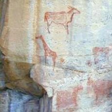
Elenantilopen
163.8 km
Scenic viewpoint
163.8 km
Omuramba Waterhole
81.9 km
Tari Kora waterhole
93.8 km
Dussi Waterhole
95.3 km
Tsau Waterhole
112.4 km
Leeupan Waterhole
111.5 km
Elandsvlakte
98.7 km
Burket Waterhole
122.5 km
Doringstraat Waterhole
124.2 km
Baikiaea Waterhole
84.5 km
Khaudum Waterhole
131.9 kmReviews
Visited this place? Tap the stars to rate it and share your experience / photos with the community! Try now! You can cancel it anytime.
Discover hidden gems everywhere you go!
From secret cafés to breathtaking viewpoints, skip the crowded tourist spots and find places that match your style. Our app makes it easy with voice search, smart filtering, route optimization, and insider tips from travelers worldwide. Download now for the complete mobile experience.

A unique approach to discovering new places❞
— Le Figaro
All the places worth exploring❞
— France Info
A tailor-made excursion in just a few clicks❞
— 20 Minutes