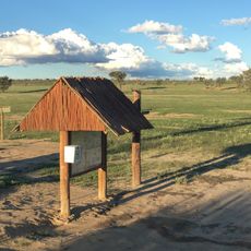
Gharagab Waterhole
Location: Mier Local Municipality
GPS coordinates: -24.92544,20.01070
Latest update: November 17, 2025 19:00
Union's End
17.6 km
Grootkolk Wilderness Camp
14.1 km
Geinab Waterhole
11.7 km
Union's End Waterhole
13.7 km
Cubitje Quap Waterhole
73.5 km
Kwang Waterhole
66.9 km
Bedinkt Waterhole
58.3 km
Langklaas Waterhole
52 km
Polentswa Waterhole
44.2 km
Kouant Waterhole
48.5 km
Kannaguass Waterhole
20.6 km
Waterhole
14 km
Dankbaar Waterhole
18.3 km
Gharagab Camp Waterhole
15.1 km
Scenic viewpoint
44.2 km
Scenic viewpoint
32.7 km
Kwang
66.8 km
Scenic viewpoint
58.4 km
Scenic viewpoint
11.6 km
Scenic viewpoint
48.5 km
Scenic viewpoint
13.7 km
Scenic viewpoint
13.4 km
Scenic viewpoint
20.7 km
Scenic viewpoint
48.5 km
Sunset Point
73.4 km
Dankbaar Waterhole
18.3 km
Gharagab Camp Waterhole
15 km
Waterhole Viewpoint
31.3 kmReviews
Visited this place? Tap the stars to rate it and share your experience / photos with the community! Try now! You can cancel it anytime.
Discover hidden gems everywhere you go!
From secret cafés to breathtaking viewpoints, skip the crowded tourist spots and find places that match your style. Our app makes it easy with voice search, smart filtering, route optimization, and insider tips from travelers worldwide. Download now for the complete mobile experience.

A unique approach to discovering new places❞
— Le Figaro
All the places worth exploring❞
— France Info
A tailor-made excursion in just a few clicks❞
— 20 Minutes