Hellicopter
Location: ខេត្តឧត្ដរមានជ័យ
GPS coordinates: 14.16448,103.29032
Latest update: October 24, 2025 15:23

Phanom Rung historical park
55.5 km
Prasat Muang Tam
49.7 km
Prasat Ta Muen Thom
20.7 km
Ta Phraya National Park
46.2 km
Prasat Ta Muen
21.3 km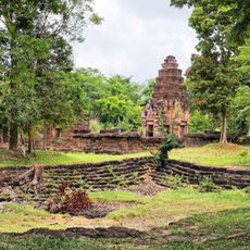
Prasat Ta Muen Tot
20.9 km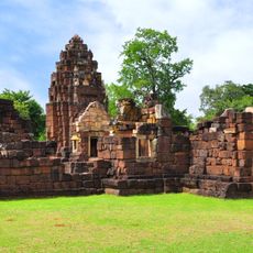
Kuti Ruesi - 2
50.5 km
Kuti Reussi n°1 (Ban Nong Bea Lai)
54.1 km
Wat Prasat Burapharam
49.5 km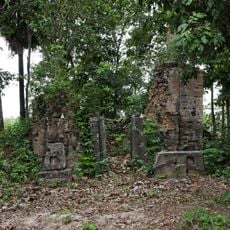
Prasat Beng
51.1 km
LBB5
16.2 km
Prasat Ta Muen
21.6 km
Helicorpter
367 m
CPP ស្រុក បន្ទាយអំពិល
303 m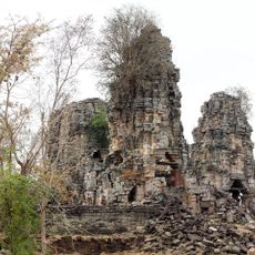
Banteay Toap
26 km
Prasat Tbeng Check Point
39.3 km
Spean Top - Ancient Khmer Empire bridge
39 km
Prasat Ta Muen Tot
21.3 km
Pinnacles
33.7 km
HELICOPTER LANDING dBB2 SVAY CHEAK
53.6 km
Takhai Temple
22.8 km
Morningstar Mansion
34.4 km
Phanom Rung Historical Park
55.5 km
Buddha
31.6 km
Ta Vong Pagode
44.1 km
Nice Platform
21.7 km
Scenic viewpoint
56.3 km
ต้นไผ่พานิช
46.3 kmReviews
Visited this place? Tap the stars to rate it and share your experience / photos with the community! Try now! You can cancel it anytime.
Discover hidden gems everywhere you go!
From secret cafés to breathtaking viewpoints, skip the crowded tourist spots and find places that match your style. Our app makes it easy with voice search, smart filtering, route optimization, and insider tips from travelers worldwide. Download now for the complete mobile experience.

A unique approach to discovering new places❞
— Le Figaro
All the places worth exploring❞
— France Info
A tailor-made excursion in just a few clicks❞
— 20 Minutes