
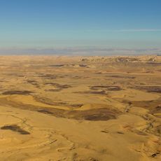
Ammonite Wall
Location: מועצה אזורית רמת נגב
GPS coordinates: 30.57596,34.87755
Latest update: October 29, 2025 22:23
Makhtesh Ramon National Park
5.7 km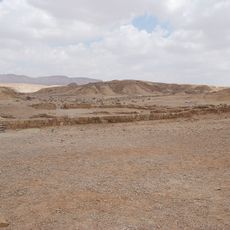
Metsad Saharonim
6.6 km
Bio Ramon
7.9 km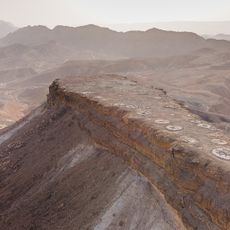
Mt. Katum
1.7 km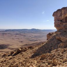
Barak & Amichai viewpoint
7.7 km
Mt. Gevanim
1.2 km
Shen Ramon viewpoint
2.3 km
זקיף רמון
6.2 km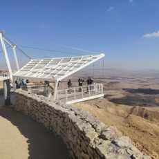
המרפסת התלויה
7.8 km
פארק לאומי צבעי המכתש
6.4 km
Scenic viewpoint
7.9 km
שער רמון
6.3 km
Scenic viewpoint
4.1 km
Scenic viewpoint
6.3 km
Scenic viewpoint
4.8 km
תצפית צפונה על מכתש רמון
5 km
Scenic viewpoint
4.5 km
Scenic viewpoint
8 km
Scenic viewpoint
4.8 km
תצפית נשרים
5.5 km
Scenic viewpoint
4.9 km
תצורת סלעים
1.2 km
Scenic viewpoint
5.9 km
ניצב סלע
6.6 km
Skatepark
8.2 km
אבן, רוח, מים
5.4 km
אנדרטת המחצבה
4.4 km
Memorial
6.7 kmReviews
Visited this place? Tap the stars to rate it and share your experience / photos with the community! Try now! You can cancel it anytime.
Discover hidden gems everywhere you go!
From secret cafés to breathtaking viewpoints, skip the crowded tourist spots and find places that match your style. Our app makes it easy with voice search, smart filtering, route optimization, and insider tips from travelers worldwide. Download now for the complete mobile experience.

A unique approach to discovering new places❞
— Le Figaro
All the places worth exploring❞
— France Info
A tailor-made excursion in just a few clicks❞
— 20 Minutes