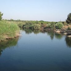
Jimbo Land
Location: מועצה אזורית עמק חפר
GPS coordinates: 32.38356,34.86794
Latest update: November 13, 2025 09:37
Alexander
1.4 km
Mikhmoret
2.5 km
Kfar Vitkin
865 m
Kfar Haim
4.4 km
Gdor Reserve
4.2 km
Samara Ruins
1.3 km
Beyt ha-Gdudim Museum
3.6 km
Shem Olam
4.2 km
גן לאומי אביחיל
2.9 km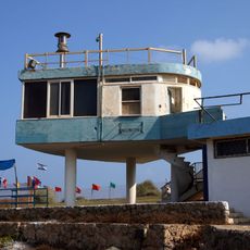
Mikhmoret Light
2.1 km
Tel H̱éfer
3.9 km
Alexander National Park
2.1 km
Gan Le'ummi H̱of Ne‘urim
1.8 km
ZUZU Gallery
3.6 km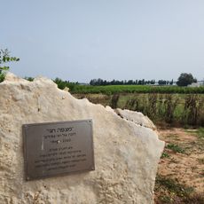
מצפה חגי
3.6 km
Homage to Jerusalem
2.9 km
Bet Yanai
1 km
Kushi
3.1 km
Bet Yanai Beach
643 m
Ein Hatekhlet Beach
2.2 km
אחוקפה
2.8 km
Kirayt Zanz Beach
4.5 km
Scenic viewpoint
359 m
Scenic viewpoint
1.3 km
Scenic viewpoint
418 m
Scenic viewpoint
3.2 km
Scenic viewpoint
3 km
תחנה לאיסוף ביצי צבים
4.4 kmReviews
Visited this place? Tap the stars to rate it and share your experience / photos with the community! Try now! You can cancel it anytime.
Discover hidden gems everywhere you go!
From secret cafés to breathtaking viewpoints, skip the crowded tourist spots and find places that match your style. Our app makes it easy with voice search, smart filtering, route optimization, and insider tips from travelers worldwide. Download now for the complete mobile experience.

A unique approach to discovering new places❞
— Le Figaro
All the places worth exploring❞
— France Info
A tailor-made excursion in just a few clicks❞
— 20 Minutes