Jogkadin Waterfall
Location: จังหวัดกาญจนบุรี
GPS coordinates: 14.68444,98.37884
Latest update: November 17, 2025 16:12
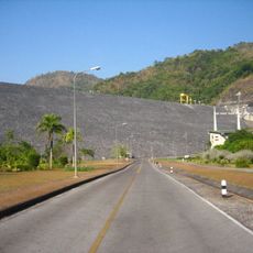
Vajiralongkorn Dam
26.7 km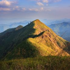
Thong Pha Phum National Park
2.8 km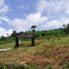
Tanintharyi Nature Reserve
13.9 km
Nam Tok Sai Kamon
17 km
ห้วยน้ำขุ่น
20 km
ท่าแพ
23.3 km
Kyauk Shat
24 km
Yaypone
26.4 km
Innpyar
27.4 km
36 Mile
27.8 km
Khao Chang phuak check point
1.5 km
Headquarters of Thong Pha Phum National Park
2.9 km
ห้วยน้ำขุ่น
20.2 km
แพมาลัย
16.7 km
9-Hole Golf Course
26 km
Old road bridge
27.2 km
Statue, Work of art
28 km
Work of art, sculpture
28 km
Waterfall View
94 m
Scenic viewpoint
1.7 km
Breathtaking view on Birma
2.2 km
Viewpoint & Parking
8.6 km
Scenic viewpoint
3.9 km
จุดชมวิวเนินช้างเผือก
3.2 km
Memorial
1.8 km
Monument
26.8 km
Wayside shrine
28 km
Waterfall
292 mReviews
Visited this place? Tap the stars to rate it and share your experience / photos with the community! Try now! You can cancel it anytime.
Discover hidden gems everywhere you go!
From secret cafés to breathtaking viewpoints, skip the crowded tourist spots and find places that match your style. Our app makes it easy with voice search, smart filtering, route optimization, and insider tips from travelers worldwide. Download now for the complete mobile experience.

A unique approach to discovering new places❞
— Le Figaro
All the places worth exploring❞
— France Info
A tailor-made excursion in just a few clicks❞
— 20 Minutes