Clarin Suman Village
Location: Misamis Occidental
GPS coordinates: 8.19415,123.85937
Latest update: October 27, 2025 21:07
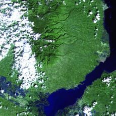
Mount Malindang
24.7 km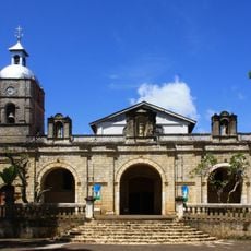
Jimenez Church
15.8 km
Fort of the Conception and Triumph
6.1 km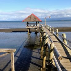
Loretos Beach Resort
3.2 km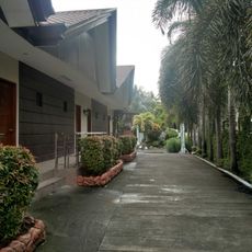
Quality Beach Resort
2.7 km
Fort of the Conception and Triumph historical marker
6.1 km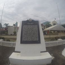
Jose F. Ozamiz historical marker
25.1 km
Fort Santiago
6.2 km
Statue, Work of art
6.2 km
Sinanduloy Cultural Center
19.1 km
3 Big Old Bells
7.6 km
Naomi's Botanical Garden
6.1 km
MAO Aloran
25.2 km
House Of Suman
19 m
The Longest Boardwalk Amusement Park
24.8 km
Asenso Ozamiz
6.2 km
Statue, Work of art
6.2 km
Statue, Work of art
6.2 km
Hoyohoy Highland Stone Chapel Adventure Park
18 km
Statue, Work of art
4.9 km
Work of art
18.3 km
Belvedere Hoyohoy View Deck
18.7 km
Hebron
15.5 km
Scenic viewpoint
17.8 km
Scenic viewpoint
17.8 km
Happy Church Cemetery
9.5 km
Jose Rizal
19.1 km
Jose Rizal
10 kmReviews
Visited this place? Tap the stars to rate it and share your experience / photos with the community! Try now! You can cancel it anytime.
Discover hidden gems everywhere you go!
From secret cafés to breathtaking viewpoints, skip the crowded tourist spots and find places that match your style. Our app makes it easy with voice search, smart filtering, route optimization, and insider tips from travelers worldwide. Download now for the complete mobile experience.

A unique approach to discovering new places❞
— Le Figaro
All the places worth exploring❞
— France Info
A tailor-made excursion in just a few clicks❞
— 20 Minutes