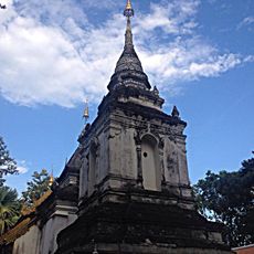
Baan Kang Wat
Location: จังหวัดเชียงใหม่
GPS coordinates: 18.77631,98.94836
Latest update: November 15, 2025 10:05

Wat Umong Suan Phutthatham
976 m
Wat Suan Dok
2.4 km
Wat Ram Poeng
148 m
Wat Pa Daeng Maha Wihan
1.3 km
Monk’s Trail Trailhead
2.5 km
Wat Fai Hin
2.5 km
Nam Tok Pha Lat
2.8 km
Night market
2.6 km
Scenic viewpoint
2.5 km
Game Tree
1.9 km
Wat Phra That Saengchan
671 m
Wat Rue Si Chi Wop
909 m
Wat Phra Non
947 m
Tree
2.8 km
Artist Village
27 m
Wat Umong - Tunnel pagoda temple
821 m
Wattana Art Gallery
1.2 km
Scenic viewpoint
2.3 km
Smoking Room
2.3 km
Wat Pha Lat Waterfall Viewpoint
2.9 km
Scenic viewpoint
2.7 km
Ruins
2.9 km
วัดเจดีย์กุด (ร้าง)
2.2 km
Monument featuring aircraft, aircraft model
2 km
พระวิษณุกรรม
2.1 km
Monk Chat
2.4 km
Ruins
2.8 km
Wat Pha Lat Waterfall
2.9 kmReviews
Visited this place? Tap the stars to rate it and share your experience / photos with the community! Try now! You can cancel it anytime.
Discover hidden gems everywhere you go!
From secret cafés to breathtaking viewpoints, skip the crowded tourist spots and find places that match your style. Our app makes it easy with voice search, smart filtering, route optimization, and insider tips from travelers worldwide. Download now for the complete mobile experience.

A unique approach to discovering new places❞
— Le Figaro
All the places worth exploring❞
— France Info
A tailor-made excursion in just a few clicks❞
— 20 Minutes