River in forest - Renting a Boat
Location: จังหวัดสุราษฎร์ธานี
GPS coordinates: 8.84004,98.96441
Latest update: November 2, 2025 21:18
Chiao Lan Lake
31.5 km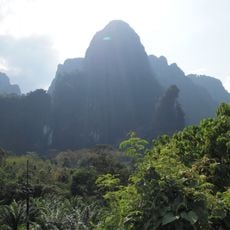
Khlong Phanom National Park
29.2 km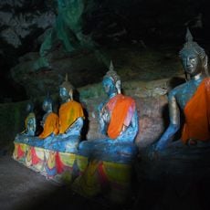
Wat Tham Singkhon
24 km
Nong Thung Thong
28.7 km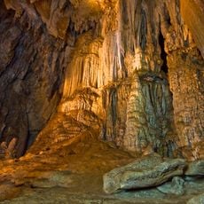
Pakarang cave
40.1 km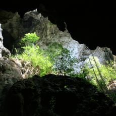
Singkhon cave
23.9 km
Klong Phanom Park Viewpoint with Coffe House
32.1 km
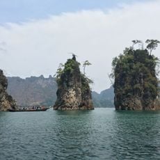
Three Rocks
33.1 km
Sanchana Farm
29 km
Station 3 - Big Tree
31.9 km
Station 4 - The Standing Nature
32 km
Station 5 - Tree on Stone
32.1 km
Station 6 - Hopes Ferrea
32.3 km
Statue, Work of art
33.1 km
Walking trail to diamond cave 17 km one way
25.1 km
Klong Phanom Park Viewpoint
32.1 km
Ratchaprapha Viewpoint
22.6 km
Hin Pad Rock
29 km
Scenic viewpoint
22.2 km
Scenic viewpoint
37.5 km
Three Stone Friends
33.1 km
Ratchaprapha Viewpoint
22.5 km
Scenic viewpoint
37.7 km
Scenic viewpoint
32.1 km
Scenic viewpoint
33.4 km
Memorial
22.5 km
Memorial
22.6 km
Waterfall, tourist attraction
26.4 kmReviews
Visited this place? Tap the stars to rate it and share your experience / photos with the community! Try now! You can cancel it anytime.
Discover hidden gems everywhere you go!
From secret cafés to breathtaking viewpoints, skip the crowded tourist spots and find places that match your style. Our app makes it easy with voice search, smart filtering, route optimization, and insider tips from travelers worldwide. Download now for the complete mobile experience.

A unique approach to discovering new places❞
— Le Figaro
All the places worth exploring❞
— France Info
A tailor-made excursion in just a few clicks❞
— 20 Minutes