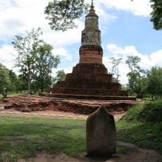
Ku Mahathat
Location: จังหวัดมหาสารคาม
GPS coordinates: 16.15827,103.41749
Latest update: November 17, 2025 06:58
Mueang Fa Daet
21 km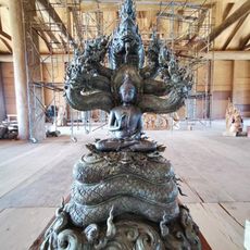
Wat Phuttha Wanaram
13.1 km
Wat Prachakhom Wanaram
20.4 km
Wat Maha Chai
12.2 km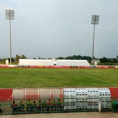
Mahasarakham Province Stadium
10.8 km
Wat Nuea
26.7 km
Wat Suwannawat
22.3 km
Wat Aphisit
11.5 km
Wat Ku Sunthraram
26.8 km
Wat Si Weluwan
8.6 km
Constitution Monument (Maha Sarakham)
12.7 km
Ang Kep Nam Kaeng Loeng Chan
16.1 km
Ang Kep Nam Huai Khakhang
20.3 km
Wat Trakhlong
25.2 km
Ang Kep Nam Huai Pradu
26.7 km
Ang Kep Nam Nong Bua
22.6 km
Ang Kep Nam Huai Aeng
6.9 km
Phra That Ya Ku
21 km
Kae Dam Bridge
15.1 km
Baan Nongnooch Hotel
23 km
พระพุทธมงคลมุนีศรีโรจนากร
20.3 km
Work of art, statue
14.3 km
พระพุทธมิ่งเมือง
22.3 km
หอนาฬิกา
12.1 km
Wat Neua
26.7 km
Ruins
20.9 km
Monument
25.4 km
เมืองฟ้าแดดสงยาง
21 kmReviews
Visited this place? Tap the stars to rate it and share your experience / photos with the community! Try now! You can cancel it anytime.
Discover hidden gems everywhere you go!
From secret cafés to breathtaking viewpoints, skip the crowded tourist spots and find places that match your style. Our app makes it easy with voice search, smart filtering, route optimization, and insider tips from travelers worldwide. Download now for the complete mobile experience.

A unique approach to discovering new places❞
— Le Figaro
All the places worth exploring❞
— France Info
A tailor-made excursion in just a few clicks❞
— 20 Minutes