Intake
Location: Taupō District
GPS coordinates: -39.20537,175.76934
Latest update: November 15, 2025 15:26
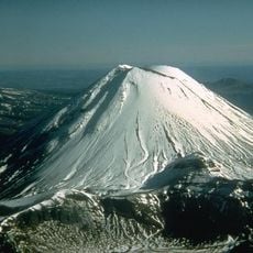
Mount Ngauruhoe
12.7 km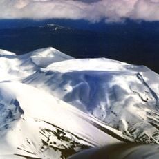
Mount Tongariro
14.3 km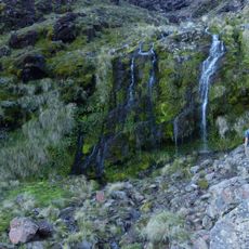
Soda Springs Falls
14.3 km
Poutu Falls
14.2 km
Waikato Falls
9.4 km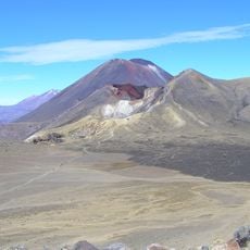
Central Crater
13.4 km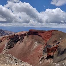
Red Crater
12.7 km
Waihohonu Hut
8.3 km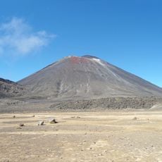
South Crater
13.2 km
Tree Trunk Gorge
4.7 km
Scenic viewpoint
14.3 km
Waterfall
9.7 km
Emerald Lakes
12.8 km
Devil's Staircase
14 km
Tongariro River Dam
9.7 km
Blue Lake
12.8 km
Waikato Falls Viewpoint
9.6 km
Andy Forster
14.3 km
Waterfall
14.3 km
Upper Tama Lake
13.7 km
Waterfall
4.9 km
Waterfall
11.5 km
Waterfall
8.8 km
Waterfall
8.8 km
Waterfall
9.7 km
Waterfall
9.2 km
Waterfall
9 km
Waterfall
14.3 kmReviews
Visited this place? Tap the stars to rate it and share your experience / photos with the community! Try now! You can cancel it anytime.
Discover hidden gems everywhere you go!
From secret cafés to breathtaking viewpoints, skip the crowded tourist spots and find places that match your style. Our app makes it easy with voice search, smart filtering, route optimization, and insider tips from travelers worldwide. Download now for the complete mobile experience.

A unique approach to discovering new places❞
— Le Figaro
All the places worth exploring❞
— France Info
A tailor-made excursion in just a few clicks❞
— 20 Minutes