Australian Pole of Inaccessibility
Location: Mount Zeil
Location: Macdonnell Region
GPS coordinates: -23.03456,132.16730
Latest update: November 22, 2025 14:10
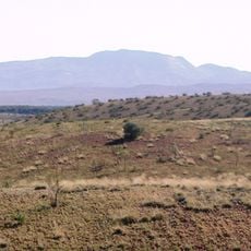
Mount Zeil
47 km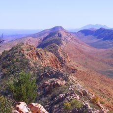
Tjoritja / West MacDonnell National Park
89.3 km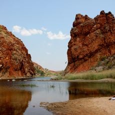
Glen Helen Gorge
89.4 km
Mount Liebig
86.9 km
Petering Park
32.3 km
George Rrurrambu Park
32 km
Obed Raggett Park
32.2 km
Amphitheatre
87.7 km
Scenic viewpoint
70.4 km
Glen Helen Gorge
89.6 km
Center of Australia - Centre of Gravity Method
9.8 km
Ormiston Pool
87.5 km
Roma Gorge
73.6 km
Gosse Bluff
88.4 km
Ormiston Gorge
87.4 km
Mount Sonder Lookout
88 km
Scenic viewpoint
88.5 km
Tylers Pass
73.7 km
Redbank Gorge
69.3 km
Scenic viewpoint
89.3 km
Ghost Gum Lookout
87.5 km
Scenic viewpoint
88.4 km
Mount Sonder Lookout
70.5 km
Scenic viewpoint
87.3 km
Lookout
98.1 km
Hilltop Lookout
79.7 km
Scenic viewpoint
46 km
Ruins
81 kmReviews
Visited this place? Tap the stars to rate it and share your experience / photos with the community! Try now! You can cancel it anytime.
Discover hidden gems everywhere you go!
From secret cafés to breathtaking viewpoints, skip the crowded tourist spots and find places that match your style. Our app makes it easy with voice search, smart filtering, route optimization, and insider tips from travelers worldwide. Download now for the complete mobile experience.

A unique approach to discovering new places❞
— Le Figaro
All the places worth exploring❞
— France Info
A tailor-made excursion in just a few clicks❞
— 20 Minutes