Eastern most point of the Australian mainland
Location: Byron Bay
Location: Byron Shire Council
GPS coordinates: -28.63606,153.63864
Latest update: November 22, 2025 14:14
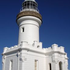
Cape Byron Light
363 m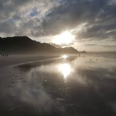
Wategos Beach
617 m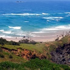
Little Wategos Beach
252 m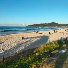
Clarkes Beach
1.2 km
Main Beach
2.2 km
Cape Byron State Conservation Area
674 m
Cape Byron Lighthouse
357 m
Scenic viewpoint
619 m
Scenic viewpoint
325 m
Clarkes Beach
1.8 km
Wategos Beach
463 m
Little Wategos Beach
280 m
Byron Bay Scout Hall
2.4 km
Cape Byron Information Centre
423 m
Cape Byron Lighthouse
358 m
The Pass
971 m
Easterly Point Lookout
78 m
Scenic viewpoint
252 m
Main Beach
2.4 km
Scenic viewpoint
539 m
Scenic viewpoint
1.1 km
Captain Cook Lookout
1.4 km
Fisherman's Lookout
1 km
Scenic viewpoint
221 m
Scenic viewpoint
115 m
Scenic viewpoint
171 m
Scenic viewpoint
390 m
Scenic viewpoint
1.1 kmReviews
Visited this place? Tap the stars to rate it and share your experience / photos with the community! Try now! You can cancel it anytime.
Discover hidden gems everywhere you go!
From secret cafés to breathtaking viewpoints, skip the crowded tourist spots and find places that match your style. Our app makes it easy with voice search, smart filtering, route optimization, and insider tips from travelers worldwide. Download now for the complete mobile experience.

A unique approach to discovering new places❞
— Le Figaro
All the places worth exploring❞
— France Info
A tailor-made excursion in just a few clicks❞
— 20 Minutes