Red Canyon
Location: Cooloola
Location: Gympie Regional
GPS coordinates: -26.10924,153.11129
Latest update: November 2, 2025 03:56
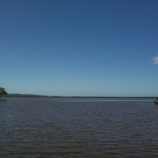
Lake Cootharaba
19.9 km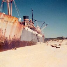
Teewah Beach
19.3 km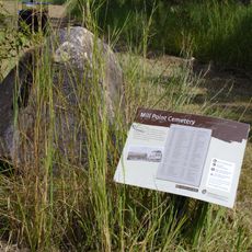
Mill Point Settlement Site
19 km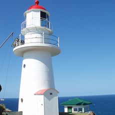
Double Island Point Light
21.2 km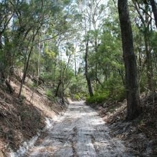
Cooloola Tramway
13.3 km
Pipeclay National Park
17.5 km
The Green House
24.8 km
Scenic viewpoint
21.4 km
Carlo Sandblow Walking Track
22.2 km
Cooloola Great Walk Seat
22.2 km
Ramsay's Hut
3.6 km
Wolf Rock Dive Site
22.6 km
Kayak pitch up (81 Lake Flat Road)
22.5 km
Cooloola Sand Patch
9.1 km
Viewpoint Overview
23.3 km
Propeller of the "Cherry Venture"
23.2 km
Carlo Dune Viewing Platform
21.8 km
Rainbow Beach Surlive Saving Hut
23.4 km
Mill Point
18.6 km
Kinaba Information Centre
16.2 km
Scenic viewpoint
16.3 km
Scenic viewpoint
21.5 km
Scenic viewpoint
16.4 km
Scenic viewpoint
23.2 km
Mount Seawah Lookout
17.7 km
Salmon Lookout
25 km
Great War Memorial
23.2 km
Anzac memorial
24.4 kmReviews
Visited this place? Tap the stars to rate it and share your experience / photos with the community! Try now! You can cancel it anytime.
Discover hidden gems everywhere you go!
From secret cafés to breathtaking viewpoints, skip the crowded tourist spots and find places that match your style. Our app makes it easy with voice search, smart filtering, route optimization, and insider tips from travelers worldwide. Download now for the complete mobile experience.

A unique approach to discovering new places❞
— Le Figaro
All the places worth exploring❞
— France Info
A tailor-made excursion in just a few clicks❞
— 20 Minutes