Pipeclay National Park, National park in Queensland, Australia
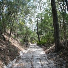
Pipeclay National Park is a small national park on the coastal plain south of the Tin Can Bay Inlet, 40 km northeast of Gympie and 5 km south of Tin Can Bay, at the end of Vendetta Avenue in Cooloola Cove. It protects heathland and open woodland with Leptospermum flavenscens, Leptospermum semibaccatum and Banksia oblongifolia, and a bora ring about 21–23 m across with a mound 15–18 cm high.
The park was created in 1963 to protect the Little Bora Ring, a site known to the Queensland government as culturally important since 1962. The ring, 21–23 m in diameter with a mound 15–18 cm high, was where the last initiation took place in 1865. It became a national park under the Nature Conservation Act 1992.
The Little Bora Ring is a ceremonial earth ring about 21–23 m across with a mound 15–18 cm high, still visible in the park. For the Aboriginal people of K'gari and the adjacent mainland it was the place where the highest level of initiation could be reached; only those initiated there were allowed to visit it. The last initiation took place in 1865, and Queensland knew the site as an important cultural place from 1962.
Access is by permit only, and recreational use is not encouraged under the park's management plan; there are no tourist facilities. The park lies at the end of Vendetta Avenue in Cooloola Cove, reached from Gympie via State Route 15 (57 km) and 5 km south of Tin Can Bay. The bora ring is still visible.
The name comes from clay deposits that both Indigenous people and European settlers used for pipe manufacturing. This local resource once shaped economic activity and settlement patterns in the area.
The community of curious travelers
AroundUs brings together thousands of curated places, local tips, and hidden gems, enriched daily by 94,399 contributors worldwide.