Poverty Rugby
Location: Gisborne District
GPS coordinates: -38.66045,178.01462
Latest update: November 17, 2025 00:26

Gisborne Botanical Gardens
681 m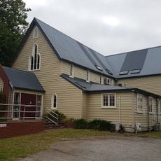
Holy Trinity Church Hall
864 m
St Andrew's Church (Presbyterian)
617 m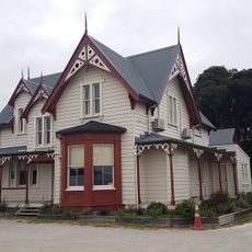
Te Rau Kahikatea
780 m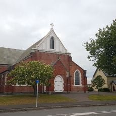
Holy Trinity Church
897 m
Pickett House
914 m
House (435 Palmerston Road)
402 m
House
943 m
House (116 Stout Street)
920 m
House (433 Palmerston Road)
403 m
Mural, Work of art
674 m
Wayside shrine
674 m
Work of art
687 m
Work of art
730 m
Tuahine Point mural
960 m
Mural, Work of art
488 m
Work of art, mural
943 m
Gisborne Holy Trinity Church memorial
876 m
Memorial, commemorative plaque
932 m
Sculpture, Work of art
931 m
Commemorative plaque, memorial
639 m
Memorial, commemorative plaque
654 m
Memorial, commemorative plaque
684 m
Memorial, commemorative plaque
738 m
Memorial, commemorative plaque
673 m
Memorial, commemorative plaque
716 m
Memorial, commemorative plaque
688 m
Memorial, commemorative plaque
722 mReviews
Visited this place? Tap the stars to rate it and share your experience / photos with the community! Try now! You can cancel it anytime.
Discover hidden gems everywhere you go!
From secret cafés to breathtaking viewpoints, skip the crowded tourist spots and find places that match your style. Our app makes it easy with voice search, smart filtering, route optimization, and insider tips from travelers worldwide. Download now for the complete mobile experience.

A unique approach to discovering new places❞
— Le Figaro
All the places worth exploring❞
— France Info
A tailor-made excursion in just a few clicks❞
— 20 Minutes