Beginning of the Gibb River Road
Location: Lake Argyle
Location: Shire Of Wyndham-East Kimberley
GPS coordinates: -15.83420,128.31170
Latest update: October 21, 2025 01:19
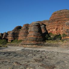
Bungle Bungle Range
184.9 km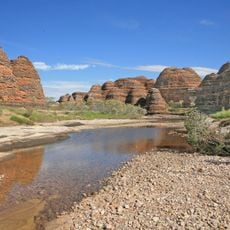
Purnululu National Park
181.5 km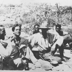
1932 Kimberley rescue
176.6 km
Keep River National Park
87.3 km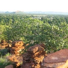
Mirima National Park
48.9 km
Marion Downs Sanctuary
156.1 km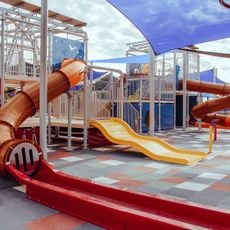
Kununurra Water Playground
46.2 km
Emma Gorge Waterfall
20.2 km
Pigeon Hole Lookout
43.4 km
Zebedee Springs
36.6 km
Chamberlain Gorge
43.9 km
Triple J River Cruise
42.1 km
Durack Homestead
56 km
Lake Argyle Dam Wall
55.8 km
Cathedral Gorge
183.4 km
Swim Beach
41.8 km
Bindoola Gorge
54.5 km
Bindoola Falls Walking Trail
61 km
Durack House
55.7 km
El Questro Gorge
37.3 km
Deep Water Crossing
38.1 km
MacMicking Pool
36.3 km
Ginger's Hill
77.9 km
Walleroo beach
57.1 km
Zebra Rock Mine CLOSED for 2021
85.2 km
Whip Snake Gorge
181.5 km
The Big Crocodile
43.5 km
Work of art, sculpture
45.8 kmReviews
Visited this place? Tap the stars to rate it and share your experience / photos with the community! Try now! You can cancel it anytime.
Discover hidden gems everywhere you go!
From secret cafés to breathtaking viewpoints, skip the crowded tourist spots and find places that match your style. Our app makes it easy with voice search, smart filtering, route optimization, and insider tips from travelers worldwide. Download now for the complete mobile experience.

A unique approach to discovering new places❞
— Le Figaro
All the places worth exploring❞
— France Info
A tailor-made excursion in just a few clicks❞
— 20 Minutes