Healing To The Nations
Location: Salem
Location: Alexandrina Council
GPS coordinates: -35.14651,139.02636
Latest update: November 22, 2025 14:21
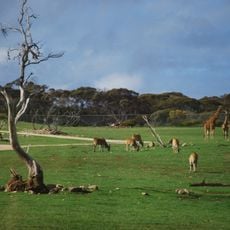
Monarto Zoo
12.8 km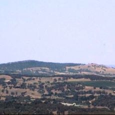
Mount Barker
13.3 km
Ferries-McDonald Conservation Park
13.5 km
Ferries-McDonald Conservation Park
13.5 km
Bonython Hill
15.1 km
Philcox Hill
14.8 km
Stirlings Hill
11.5 km
Tinpot
8.2 km
Disher Hill
11 km
Work of art, sculpture
15.2 km
Ruins
5.9 km
Bretag Farm Ruins
13.4 km
Tracks of Tjirbruki
15.2 km
Tear Drops
15.2 km
Mt Barker-Hahndorf Golf Club
14.8 km
Scenic viewpoint
13.2 km
Giraffe Viewing Platform
12.8 km
Eclair Mine
4.6 km
The Salem Olive Farm
295 m
Ruins
11.3 km
Ruins
10.5 km
Ruins
4.6 km
Ruins
4.3 km
Ruins
4.2 km
Old farm house
5 km
Old farm house
4.9 km
Old Salem Ruins
1.3 km
Abandoned Car
12.7 kmReviews
Visited this place? Tap the stars to rate it and share your experience / photos with the community! Try now! You can cancel it anytime.
Discover hidden gems everywhere you go!
From secret cafés to breathtaking viewpoints, skip the crowded tourist spots and find places that match your style. Our app makes it easy with voice search, smart filtering, route optimization, and insider tips from travelers worldwide. Download now for the complete mobile experience.

A unique approach to discovering new places❞
— Le Figaro
All the places worth exploring❞
— France Info
A tailor-made excursion in just a few clicks❞
— 20 Minutes