Gedenktafel
Location: Stadtbezirk III
Location: Essen
GPS coordinates: 51.45161,6.96074
Latest update: October 11, 2024 03:25
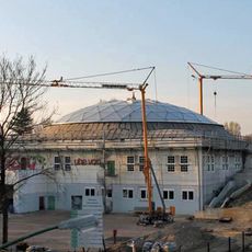
DITIB-Zentralmoschee Essen
651 m
St. Antonius
976 m
Apostelkirche
1.1 km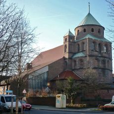
St. Elisabeth
313 m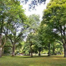
Gervinuspark
629 m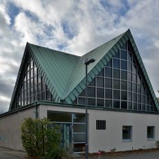
Markuskirche
589 m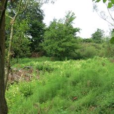
Kamptal
1.1 km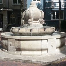
Gänsereiterbrunnen
1.1 km
LSG-Muehlenbach - Frohnhauser Weg
825 m
LSG-Gleisdreieck
568 m
LSG-Kaldenhofs Kamp und Grosser Kamp
1.2 km
Gedenktafel
849 m
Gedenktafel Kriegsgefangenenlager
269 m
Karl Wolf
802 m
Gedenkstein
696 m
Gräber KZ-Opfer
830 m
Der leere Raum
329 m
Gräber KZ-Opfer und Kriegsgefangene
879 m
Gräber KZ-Opfer und Kriegsgefangene
926 m
Wayside cross
942 m
Gedenktafel
774 m
Heinrich Hirtsiefer
986 m
Wayside shrine, Christianity
648 m
Altelier Modern Art
1.1 km
90 Jahre Sport Altendorf
1.1 km
Gedenktafel
481 m
Gänsereiterskulptur
171 m
Work of art
1.1 kmReviews
Visited this place? Tap the stars to rate it and share your experience / photos with the community! Try now! You can cancel it anytime.
Discover hidden gems everywhere you go!
From secret cafés to breathtaking viewpoints, skip the crowded tourist spots and find places that match your style. Our app makes it easy with voice search, smart filtering, route optimization, and insider tips from travelers worldwide. Download now for the complete mobile experience.

A unique approach to discovering new places❞
— Le Figaro
All the places worth exploring❞
— France Info
A tailor-made excursion in just a few clicks❞
— 20 Minutes